Walbourg geodata
Walbourg (Grand Est) is a populated place; located in France in Europe/Paris (GMT+2) time zone. With population of 1,161 people, there are 7758 cities with bigger population in this country. Compared to other cities in France, 77.3% of cities are located further ↓South; 99.2% of cities are located further ←West and 59.6% of cities have lower elevation than Walbourg. Note1
Administrative division(s):
- Level 1: Grand Est
- Level 2: Bas-Rhin
- Level 3: Arrondissement de Haguenau-Wissembourg
- Level 4: Walbourg


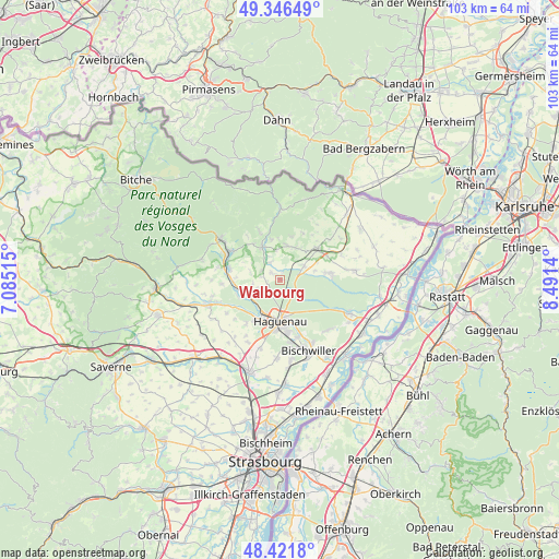
Walbourg GPS coordinates[2]
48° 53' 10.608" North, 7° 47' 17.808" East
| Map corner | latitude | longitude |
|---|---|---|
| Upper-left | 49.34649°, | 7.08515° |
| Center: | 48.88628°, | 7.78828° |
| Lower-right: | 48.4218°, | 8.4914° |
| Map W x H: | 102.8×102.8 km | = 63.9×63.9mi |
| max Lat: | 51.07786° ⇑22.7% North |
| Walbourg: | 48.88628° |
| min Lat: | ⇓77.3% South 41.3874° |
| min Long | Walbourg | max Long |
| -5.08615° | 7.78828° | 9.52242° |
| W 99.2%⇐ | ⇒0.8% E |
Elevation
Elevation of Walbourg is 168 m = 551 ft, and this is 25.7 m = 84 ft below average elevation for this country.
| Max E: |
2333 m = 7654 ft | 40.4% |
| Avg. | 193.7 m = 635 ft | |
| Walbourg | 168 m = 551 ft | |
Min E: |
-1 m = -3 ft | 59.6% |
See also: France elevation on elevation.city.
Geographical zone
Walbourg is located in North temperate zone (between Tropic of Cancer and the Arctic Circle). Distance of this North polar circle is 1965.5 km =1221.3 mi to North.| Distance of | km | miles | from Walbourg |
|---|---|---|---|
| North Pole | 4571.4 | 2840.5 | to North |
| Arctic Circle | 1965.5 | 1221.3 | to North |
| Tropic Cancer | 2829.7 | 1758.3 | to South |
| Equator | 5435.6 | 3377.5 | to South |


Nearby cities:
15 places around Walbourg: (largest is in red/bold)
• Betschdorf
8.4 km =5.2 mi,  80°
80°
• Durrenbach
1.9 km =1.2 mi,  307°
307°
• Eschbach
4 km =2.5 mi,  251°
251°
• Forstheim
5.4 km =3.4 mi,  280°
280°
• Gunstett
3.6 km =2.2 mi,  329°
329°
• Gœrsdorf
7.3 km =4.5 mi,  347°
347°
• Haguenau
7.9 km =4.9 mi,  178°
178°
• Kutzenhausen
7.1 km =4.4 mi,  42°
42°
• Lampertsloch
8.2 km =5.1 mi,  13°
13°
• Merkwiller-Pechelbronn
6.4 km =4 mi,  27°
27°
• Mertzwiller
8.2 km =5.1 mi, 253°
• Morsbronn-les-Bains
3.7 km =2.3 mi,  297°
297°
• Preuschdorf
6.6 km =4.1 mi, 8°
• Surbourg
5.1 km =3.2 mi,  58°
58°
• Woerth
6.8 km =4.2 mi, 330°
Sources, notices
• [Note1] Compared only with cities in France existing in our database
• [Src1] Map data: © OpenStreetMap contributors (CC-BY-SA)
• [Src2] Other city data from geonames.org with taken over terms of usage.
• [Src3] Geographical zone / Annual Mean Temperature by Robert A. Rohde @ Wikipedia
