Eschbach geodata
Eschbach (Grand Est) is a populated place; located in France in Europe/Paris (GMT+2) time zone. With population of 1,012 people, there are 8758 cities with bigger population in this country. Compared to other cities in France, 77.1% of cities are located further ↓South; 99.1% of cities are located further ←West and 63.6% of cities have lower elevation than Eschbach. Note1
Administrative division(s):
- Level 1: Grand Est
- Level 2: Bas-Rhin
- Level 3: Arrondissement de Haguenau-Wissembourg
- Level 4: Eschbach


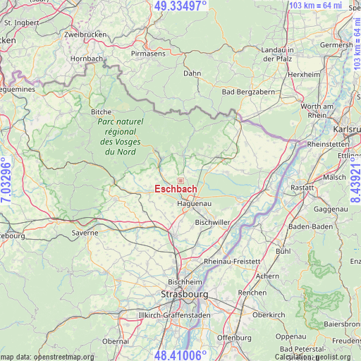
Eschbach GPS coordinates[2]
48° 52' 28.74" North, 7° 44' 9.924" East
| Map corner | latitude | longitude |
|---|---|---|
| Upper-left | 49.33497°, | 7.03296° |
| Center: | 48.87465°, | 7.73609° |
| Lower-right: | 48.41006°, | 8.43921° |
| Map W x H: | 102.8×102.8 km | = 63.9×63.9mi |
| max Lat: | 51.07786° ⇑22.9% North |
| Eschbach: | 48.87465° |
| min Lat: | ⇓77.1% South 41.3874° |
| min Long | Eschbach | max Long |
| -5.08615° | 7.73609° | 9.52242° |
| W 99.1%⇐ | ⇒0.90000000000001% E |
Elevation
Elevation of Eschbach is 187 m = 614 ft, and this is 6.7 m = 22 ft below average elevation for this country.
| Max E: |
2333 m = 7654 ft | 36.4% |
| Avg. | 193.7 m = 635 ft | |
| Eschbach | 187 m = 614 ft | |
Min E: |
-1 m = -3 ft | 63.6% |
See also: France elevation on elevation.city.
Geographical zone
Eschbach is located in North temperate zone (between Tropic of Cancer and the Arctic Circle). Distance of this North polar circle is 1966.8 km =1222.1 mi to North.| Distance of | km | miles | from Eschbach |
|---|---|---|---|
| North Pole | 4572.7 | 2841.3 | to North |
| Arctic Circle | 1966.8 | 1222.1 | to North |
| Tropic Cancer | 2828.4 | 1757.5 | to South |
| Equator | 5434.4 | 3376.8 | to South |


Nearby cities:
15 places around Eschbach: (largest is in red/bold)
• Dauendorf
7.7 km =4.8 mi,  229°
229°
• Durrenbach
3.4 km =2.1 mi,  43°
43°
• Forstheim
2.7 km =1.7 mi,  325°
325°
• Gundershoffen
6.5 km =4 mi,  302°
302°
• Gunstett
4.8 km =3 mi,  24°
24°
• Haguenau
7.7 km =4.8 mi,  148°
148°
• Mertzwiller
4.1 km =2.5 mi,  255°
255°
• Mietesheim
6.9 km =4.3 mi,  273°
273°
• Morsbronn-les-Bains
3.1 km =1.9 mi,  10°
10°
• Ohlungen
7.2 km =4.5 mi,  200°
200°
• Schweighouse-sur-Moder
6.1 km =3.8 mi,  185°
185°
• Uberach
8.3 km =5.2 mi,  250°
250°
• Uhlwiller
7.5 km =4.7 mi,  217°
217°
• Walbourg
4 km =2.5 mi,  71°
71°
• Woerth
7.2 km =4.5 mi,  3°
3°
Sources, notices
• [Note1] Compared only with cities in France existing in our database
• [Src1] Map data: © OpenStreetMap contributors (CC-BY-SA)
• [Src2] Other city data from geonames.org with taken over terms of usage.
• [Src3] Geographical zone / Annual Mean Temperature by Robert A. Rohde @ Wikipedia
