Wahagnies geodata
Wahagnies (Hauts-de-France) is a populated place; located in France in Europe/Paris (GMT+2) time zone. With population of 2,736 people, there are 3582 cities with bigger population in this country. Compared to other cities in France, 97.2% of cities are located further ↓South; 58.3% of cities are located further ←West and 80.2% of cities have higher elevation than Wahagnies. Note1
Administrative division(s):
- Level 1: Hauts-de-France
- Level 2: Nord
- Level 3: Arrondissement de Lille
- Level 4: Wahagnies


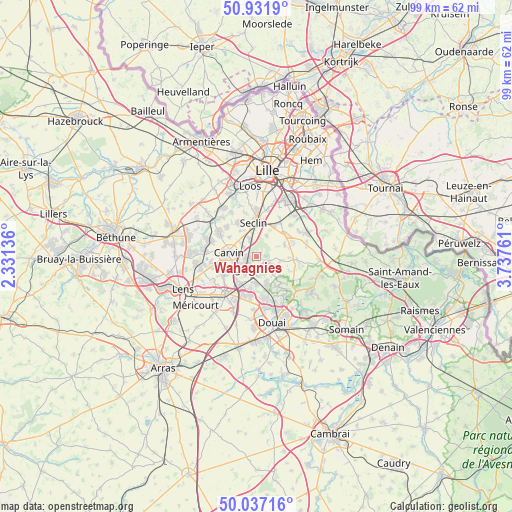
Wahagnies GPS coordinates[2]
50° 29' 11.94" North, 3° 2' 4.128" East
| Map corner | latitude | longitude |
|---|---|---|
| Upper-left | 50.9319°, | 2.33136° |
| Center: | 50.48665°, | 3.03448° |
| Lower-right: | 50.03716°, | 3.73761° |
| Map W x H: | 99.5×99.5 km | = 61.8×61.8mi |
| max Lat: | 51.07786° ⇑2.8% North |
| Wahagnies: | 50.48665° |
| min Lat: | ⇓97.2% South 41.3874° |
| min Long | Wahagnies | max Long |
| -5.08615° | 3.03448° | 9.52242° |
| W 58.3%⇐ | ⇒41.7% E |
Elevation
Elevation of Wahagnies is 54 m = 177 ft, and this is 139.7 m = 458 ft below average elevation for this country.
| Max E: |
2333 m = 7654 ft | 80.2% |
| Avg. | 193.7 m = 635 ft | |
| Wahagnies | 54 m = 177 ft | |
Min E: |
-1 m = -3 ft | 19.8% |
See also: France elevation on elevation.city.
Geographical zone
Wahagnies is located in North temperate zone (between Tropic of Cancer and the Arctic Circle). Distance of this North polar circle is 1787.6 km =1110.8 mi to North.| Distance of | km | miles | from Wahagnies |
|---|---|---|---|
| North Pole | 4393.5 | 2730 | to North |
| Arctic Circle | 1787.6 | 1110.8 | to North |
| Tropic Cancer | 3007.7 | 1868.9 | to South |
| Equator | 5613.6 | 3488.1 | to South |


Nearby cities:
15 places around Wahagnies: (largest is in red/bold)
• Attiches
4.4 km =2.7 mi,  26°
26°
• Camphin-en-Carembault
4.4 km =2.7 mi,  310°
310°
• Carvin
5.4 km =3.4 mi,  276°
276°
• Chemy
5.9 km =3.7 mi,  326°
326°
• La Neuville
1.2 km =0.7 mi,  53°
53°
• Leforest
5.8 km =3.6 mi,  158°
158°
• Libercourt
1.4 km =0.9 mi,  253°
253°
• Mons-en-Pévèle
4.5 km =2.8 mi,  100°
100°
• Mérignies
5.8 km =3.6 mi,  68°
68°
• Oignies
3.9 km =2.4 mi,  227°
227°
• Ostricourt
3.9 km =2.4 mi,  180°
180°
• Phalempin
3.6 km =2.2 mi,  338°
338°
• Thumeries
1.8 km =1.1 mi,  127°
127°
• Tourmignies
4.2 km =2.6 mi,  56°
56°
• Évin-Malmaison
5.3 km =3.3 mi, 182°
Sources, notices
• [Note1] Compared only with cities in France existing in our database
• [Src1] Map data: © OpenStreetMap contributors (CC-BY-SA)
• [Src2] Other city data from geonames.org with taken over terms of usage.
• [Src3] Geographical zone / Annual Mean Temperature by Robert A. Rohde @ Wikipedia
