Vouvant geodata
Vouvant (Pays de la Loire) is a populated place; located in France in Europe/Paris (GMT+2) time zone. With population of 968 people, there are 9076 cities with bigger population in this country. Compared to other cities in France, 59.5% of cities are located further ↑North; 86.2% of cities are located further →East and 73.1% of cities have higher elevation than Vouvant. Note1
Administrative division(s):
- Level 1: Pays de la Loire
- Level 2: Département de la Vendée
- Level 3: Arrondissement de Fontenay-le-Comte
- Level 4: Vouvant


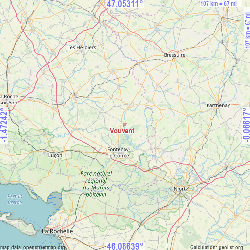
Vouvant GPS coordinates[2]
46° 34' 18.84" North, 0° 46' 9.444" West
| Map corner | latitude | longitude |
|---|---|---|
| Upper-left | 47.05311°, | -1.47242° |
| Center: | 46.5719°, | -0.76929° |
| Lower-right: | 46.08639°, | -0.06617° |
| Map W x H: | 107.5×107.5 km | = 66.8×66.8mi |
| max Lat: | 51.07786° ⇑59.5% North |
| Vouvant: | 46.5719° |
| min Lat: | ⇓40.5% South 41.3874° |
| min Long | Vouvant | max Long |
| -5.08615° | -0.76929° | 9.52242° |
| W 13.8%⇐ | ⇒86.2% E |
Elevation
Elevation of Vouvant is 71 m = 233 ft, and this is 122.7 m = 403 ft below average elevation for this country.
| Max E: |
2333 m = 7654 ft | 73.1% |
| Avg. | 193.7 m = 635 ft | |
| Vouvant | 71 m = 233 ft | |
Min E: |
-1 m = -3 ft | 26.9% |
See also: France elevation on elevation.city.
Geographical zone
Vouvant is located in North temperate zone (between Tropic of Cancer and the Arctic Circle). Distance of this North polar circle is 2222.9 km =1381.2 mi to North.| Distance of | km | miles | from Vouvant |
|---|---|---|---|
| North Pole | 4828.8 | 3000.5 | to North |
| Arctic Circle | 2222.9 | 1381.2 | to North |
| Tropic Cancer | 2572.4 | 1598.4 | to South |
| Equator | 5178.3 | 3217.6 | to South |


Nearby cities:
15 places around Vouvant: (largest is in red/bold)
• Antigny
5.5 km =3.4 mi,  359°
359°
• Bourneau
5.2 km =3.2 mi,  225°
225°
• Foussais-Payré
7.8 km =4.8 mi,  123°
123°
• La Châtaigneraie
8.8 km =5.5 mi,  15°
15°
• La Tardière
10.3 km =6.4 mi, 16°
• Marsais-Sainte-Radégonde
9.3 km =5.8 mi,  245°
245°
• Mervent
5.6 km =3.5 mi,  169°
169°
• Pissotte
8.8 km =5.5 mi,  199°
199°
• Saint-Cyr-des-Gâts
8.7 km =5.4 mi,  268°
268°
• Saint-Hilaire-de-Voust
9.4 km =5.8 mi,  77°
77°
• Saint-Maurice-des-Noues
4.9 km =3 mi,  46°
46°
• Saint-Maurice-le-Girard
8.4 km =5.2 mi,  340°
340°
• Saint-Michel-le-Cloucq
9.7 km =6 mi, 172°
• Sérigné
9.8 km =6.1 mi,  216°
216°
• Thouarsais-Bouildroux
9.9 km =6.2 mi,  301°
301°
Sources, notices
• [Note1] Compared only with cities in France existing in our database
• [Src1] Map data: © OpenStreetMap contributors (CC-BY-SA)
• [Src2] Other city data from geonames.org with taken over terms of usage.
• [Src3] Geographical zone / Annual Mean Temperature by Robert A. Rohde @ Wikipedia
