Thouarsais-Bouildroux geodata
Thouarsais-Bouildroux (Pays de la Loire) is a populated place; located in France in Europe/Paris (GMT+2) time zone. With population of 677 people, there are 12108 cities with bigger population in this country. Compared to other cities in France, 59.1% of cities are located further ↑North; 87.1% of cities are located further →East and 69.2% of cities have higher elevation than Thouarsais-Bouildroux. Note1
Administrative division(s):
- Level 1: Pays de la Loire
- Level 2: Département de la Vendée
- Level 3: Arrondissement de Fontenay-le-Comte
- Level 4: Thouarsais-Bouildroux
Current local time in Thouarsais-Bouildroux:
12:14 PM, SaturdayDifference from your time zone: hours


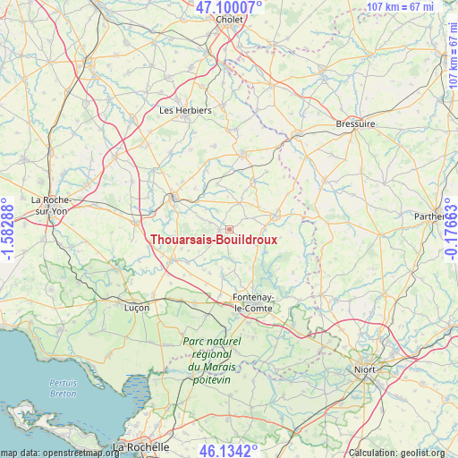
Thouarsais-Bouildroux GPS coordinates[2]
46° 37' 9.444" North, 0° 52' 47.1" West
| Map corner | latitude | longitude |
|---|---|---|
| Upper-left | 47.10007°, | -1.58288° |
| Center: | 46.61929°, | -0.87975° |
| Lower-right: | 46.1342°, | -0.17663° |
| Map W x H: | 107.4×107.4 km | = 66.7×66.7mi |
| max Lat: | 51.07786° ⇑59.1% North |
| Thouarsais-Bouildroux: | 46.61929° |
| min Lat: | ⇓40.9% South 41.3874° |
| min Long | Thouarsais-Boui | max Long |
| -5.08615° | -0.87975° | 9.52242° |
| W 12.9%⇐ | ⇒87.1% E |
Elevation
Elevation of Thouarsais-Bouildroux is 80 m = 262 ft, and this is 113.7 m = 373 ft below average elevation for this country.
| Max E: |
2333 m = 7654 ft | 69.2% |
| Avg. | 193.7 m = 635 ft | |
| Thouarsais-Bouildroux | 80 m = 262 ft | |
Min E: |
-1 m = -3 ft | 30.8% |
See also: France elevation on elevation.city.
Geographical zone
Thouarsais-Bouildroux is located in North temperate zone (between Tropic of Cancer and the Arctic Circle). Distance of this North polar circle is 2217.6 km =1378 mi to North.| Distance of | km | miles | from Thouarsais-Bouildroux |
|---|---|---|---|
| North Pole | 4823.5 | 2997.2 | to North |
| Arctic Circle | 2217.6 | 1378 | to North |
| Tropic Cancer | 2577.7 | 1601.7 | to South |
| Equator | 5183.6 | 3220.9 | to South |


Nearby cities:
15 places around Thouarsais-Bouildroux: (largest is in red/bold)
• Antigny
8.4 km =5.2 mi,  88°
88°
• Bazoges-en-Pareds
5 km =3.1 mi,  326°
326°
• Bourneau
10.1 km =6.3 mi,  151°
151°
• Chavagnes-les-Redoux
11 km =6.8 mi,  344°
344°
• Cheffois
8.8 km =5.5 mi,  51°
51°
• La Châtaigneraie
11.2 km =7 mi,  73°
73°
• La Jaudonnière
6.9 km =4.3 mi,  292°
292°
• La Tardière
12.2 km =7.6 mi, 67°
• Marsais-Sainte-Radégonde
9.1 km =5.7 mi,  179°
179°
• Mouilleron-en-Pareds
6.7 km =4.2 mi,  20°
20°
• Réaumur
12.6 km =7.8 mi,  27°
27°
• Saint-Cyr-des-Gâts
5.5 km =3.4 mi, 182°
• Saint-Maurice-des-Noues
12.2 km =7.6 mi,  99°
99°
• Saint-Maurice-le-Girard
6.3 km =3.9 mi,  64°
64°
• Vouvant
9.9 km =6.2 mi,  121°
121°
Sources, notices
• [Note1] Compared only with cities in France existing in our database
• [Src1] Map data: © OpenStreetMap contributors (CC-BY-SA)
• [Src2] Other city data from geonames.org with taken over terms of usage.
• [Src3] Geographical zone / Annual Mean Temperature by Robert A. Rohde @ Wikipedia
