Virieu-le-Grand geodata
Virieu-le-Grand (Auvergne-Rhône-Alpes) is a populated place; located in France in Europe/Paris (GMT+2) time zone. With population of 1,044 people, there are 8506 cities with bigger population in this country. Compared to other cities in France, 68.5% of cities are located further ↑North; 84.1% of cities are located further ←West and 87% of cities have lower elevation than Virieu-le-Grand. Note1
Administrative division(s):
- Level 1: Auvergne-Rhône-Alpes
- Level 2: Département de l'Ain
- Level 3: Arrondissement de Belley
- Level 4: Virieu-le-Grand


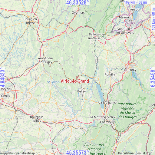
Virieu-le-Grand GPS coordinates[2]
45° 50' 51.576" North, 5° 39' 5.256" East
| Map corner | latitude | longitude |
|---|---|---|
| Upper-left | 46.33528°, | 4.94833° |
| Center: | 45.84766°, | 5.65146° |
| Lower-right: | 45.35573°, | 6.35458° |
| Map W x H: | 108.9×108.9 km | = 67.7×67.7mi |
| max Lat: | 51.07786° ⇑68.5% North |
| Virieu-le-Grand: | 45.84766° |
| min Lat: | ⇓31.5% South 41.3874° |
| min Long | Virieu-le-Grand | max Long |
| -5.08615° | 5.65146° | 9.52242° |
| W 84.1%⇐ | ⇒15.9% E |
Elevation
Elevation of Virieu-le-Grand is 373 m = 1224 ft, and this is 179.3 m = 588 ft above average elevation for this country.
| Max E: |
2333 m = 7654 ft | 13% |
| Virieu-le-Grand | 373 m 1224 ft | |
| Avg. | 193.7 m = 635 ft | |
Min E: |
-1 m = -3 ft | 87% |
See also: France elevation on elevation.city.
Geographical zone
Virieu-le-Grand is located in North temperate zone (between Tropic of Cancer and the Arctic Circle). Distance of this North polar circle is 2303.4 km =1431.3 mi to North.| Distance of | km | miles | from Virieu-le-Grand |
|---|---|---|---|
| North Pole | 4909.3 | 3050.5 | to North |
| Arctic Circle | 2303.4 | 1431.3 | to North |
| Tropic Cancer | 2491.9 | 1548.4 | to South |
| Equator | 5097.8 | 3167.6 | to South |


Nearby cities:
15 places around Virieu-le-Grand: (largest is in red/bold)
• Anglefort
14.1 km =8.8 mi,  59°
59°
• Artemare
4.4 km =2.7 mi,  47°
47°
• Belley
10.2 km =6.3 mi,  163°
163°
• Brens
13.4 km =8.3 mi,  166°
166°
• Ceyzérieu
6 km =3.7 mi,  103°
103°
• Chanaz
11.9 km =7.4 mi,  111°
111°
• Chazey-Bons
5.4 km =3.4 mi,  153°
153°
• Cormaranche-en-Bugey
12 km =7.5 mi,  345°
345°
• Culoz
10.4 km =6.5 mi,  89°
89°
• Hauteville-Lompnes
15 km =9.3 mi,  344°
344°
• Lhuis
14.6 km =9.1 mi,  216°
216°
• Massignieu-de-Rives
13.6 km =8.5 mi,  139°
139°
• Ruffieux
14.9 km =9.3 mi, 89°
• Tenay
13.6 km =8.5 mi,  305°
305°
• Virignin
15.1 km =9.4 mi, 161°
Sources, notices
• [Note1] Compared only with cities in France existing in our database
• [Src1] Map data: © OpenStreetMap contributors (CC-BY-SA)
• [Src2] Other city data from geonames.org with taken over terms of usage.
• [Src3] Geographical zone / Annual Mean Temperature by Robert A. Rohde @ Wikipedia
