Virazeil geodata
Virazeil (Nouvelle-Aquitaine) is a populated place; located in France in Europe/Paris (GMT+2) time zone. With population of 1,557 people, there are 5984 cities with bigger population in this country. Compared to other cities in France, 83.5% of cities are located further ↑North; 76.1% of cities are located further →East and 83.1% of cities have higher elevation than Virazeil. Note1
Administrative division(s):
- Level 1: Nouvelle-Aquitaine
- Level 2: Département du Lot-et-Garonne
- Level 3: Arrondissement de Marmande
- Level 4: Virazeil


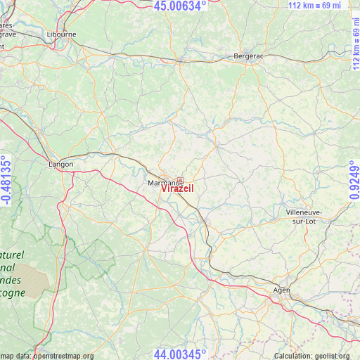
Virazeil GPS coordinates[2]
44° 30' 25.38" North, 0° 13' 18.372" East
| Map corner | latitude | longitude |
|---|---|---|
| Upper-left | 45.00634°, | -0.48135° |
| Center: | 44.50705°, | 0.22177° |
| Lower-right: | 44.00345°, | 0.9249° |
| Map W x H: | 111.5×111.5 km | = 69.3×69.3mi |
| max Lat: | 51.07786° ⇑83.5% North |
| Virazeil: | 44.50705° |
| min Lat: | ⇓16.5% South 41.3874° |
| min Long | Virazeil | max Long |
| -5.08615° | 0.22177° | 9.52242° |
| W 23.9%⇐ | ⇒76.1% E |
Elevation
Elevation of Virazeil is 47 m = 154 ft, and this is 146.7 m = 481 ft below average elevation for this country.
| Max E: |
2333 m = 7654 ft | 83.1% |
| Avg. | 193.7 m = 635 ft | |
| Virazeil | 47 m = 154 ft | |
Min E: |
-1 m = -3 ft | 16.9% |
See also: France elevation on elevation.city.
Geographical zone
Virazeil is located in North temperate zone (between Tropic of Cancer and the Arctic Circle). Distance of this Northern Tropic circle is 2342.8 km =1455.7 mi to South.| Distance of | km | miles | from Virazeil |
|---|---|---|---|
| North Pole | 5058.3 | 3143.1 | to North |
| Arctic Circle | 2452.5 | 1523.9 | to North |
| Tropic Cancer | 2342.8 | 1455.7 | to South |
| Equator | 4948.7 | 3075 | to South |


Nearby cities:
15 places around Virazeil: (largest is in red/bold)
• Beaupuy
6.6 km =4.1 mi,  298°
298°
• Birac-sur-Trec
4.3 km =2.7 mi,  123°
123°
• Castelnau-sur-Gupie
9.1 km =5.7 mi,  309°
309°
• Caumont-sur-Garonne
8.3 km =5.2 mi,  202°
202°
• Escassefort
4.8 km =3 mi,  16°
16°
• Fauguerolles
7.6 km =4.7 mi,  162°
162°
• Fourques-sur-Garonne
8.3 km =5.2 mi,  218°
218°
• Gontaud-de-Nogaret
8.9 km =5.5 mi,  135°
135°
• Lagupie
10.1 km =6.3 mi, 301°
• Marmande
4.5 km =2.8 mi,  260°
260°
• Montpouillan
10.2 km =6.3 mi,  244°
244°
• Puymiclan
7.5 km =4.7 mi,  85°
85°
• Saint-Pardoux-du-Breuil
4.1 km =2.5 mi,  212°
212°
• Sainte-Bazeille
10.2 km =6.3 mi,  284°
284°
• Seyches
8.3 km =5.2 mi,  54°
54°
Sources, notices
• [Note1] Compared only with cities in France existing in our database
• [Src1] Map data: © OpenStreetMap contributors (CC-BY-SA)
• [Src2] Other city data from geonames.org with taken over terms of usage.
• [Src3] Geographical zone / Annual Mean Temperature by Robert A. Rohde @ Wikipedia
