Saint-Pardoux-du-Breuil geodata
Saint-Pardoux-du-Breuil (Nouvelle-Aquitaine) is a populated place; located in France in Europe/Paris (GMT+2) time zone. With population of 618 people, there are 13020 cities with bigger population in this country. Compared to other cities in France, 83.8% of cities are located further ↑North; 76.3% of cities are located further →East and 89.9% of cities have higher elevation than Saint-Pardoux-du-Breuil. Note1
Administrative division(s):
- Level 1: Nouvelle-Aquitaine
- Level 2: Département du Lot-et-Garonne
- Level 3: Arrondissement de Marmande
- Level 4: Saint-Pardoux-du-Breuil
Current local time in Saint-Pardoux-du-Breuil:
02:21 PM, SaturdayDifference from your time zone: hours


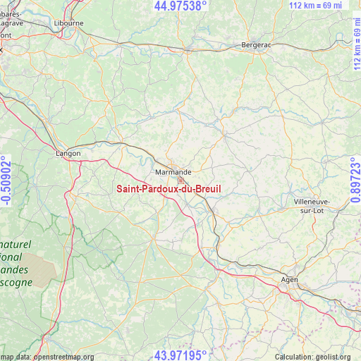
Saint-Pardoux-du-Breuil GPS coordinates[2]
44° 28' 32.952" North, 0° 11' 38.796" East
| Map corner | latitude | longitude |
|---|---|---|
| Upper-left | 44.97538°, | -0.50902° |
| Center: | 44.47582°, | 0.19411° |
| Lower-right: | 43.97195°, | 0.89723° |
| Map W x H: | 111.6×111.6 km | = 69.3×69.3mi |
| max Lat: | 51.07786° ⇑83.8% North |
| Saint-Pardoux-du-Breuil: | 44.47582° |
| min Lat: | ⇓16.2% South 41.3874° |
| min Long | Saint-Pardoux-d | max Long |
| -5.08615° | 0.19411° | 9.52242° |
| W 23.7%⇐ | ⇒76.3% E |
Elevation
Elevation of Saint-Pardoux-du-Breuil is 30 m = 98 ft, and this is 163.7 m = 537 ft below average elevation for this country.
| Max E: |
2333 m = 7654 ft | 89.9% |
| Avg. | 193.7 m = 635 ft | |
| Saint-Pardoux-du-Breuil | 30 m = 98 ft | |
Min E: |
-1 m = -3 ft | 10.1% |
See also: France elevation on elevation.city.
Geographical zone
Saint-Pardoux-du-Breuil is located in North temperate zone (between Tropic of Cancer and the Arctic Circle). Distance of this Northern Tropic circle is 2339.3 km =1453.6 mi to South.| Distance of | km | miles | from Saint-Pardoux-du-Breuil |
|---|---|---|---|
| North Pole | 5061.8 | 3145.3 | to North |
| Arctic Circle | 2455.9 | 1526 | to North |
| Tropic Cancer | 2339.3 | 1453.6 | to South |
| Equator | 4945.2 | 3072.8 | to South |


Nearby cities:
15 places around Saint-Pardoux-du-Breuil: (largest is in red/bold)
• Beaupuy
7.5 km =4.7 mi,  331°
331°
• Birac-sur-Trec
5.9 km =3.7 mi,  79°
79°
• Caumont-sur-Garonne
4.3 km =2.7 mi,  193°
193°
• Escassefort
8.8 km =5.5 mi,  23°
23°
• Fauguerolles
5.8 km =3.6 mi,  130°
130°
• Fauillet
9.4 km =5.8 mi, 125°
• Fourques-sur-Garonne
4.3 km =2.7 mi,  223°
223°
• Gontaud-de-Nogaret
8.9 km =5.5 mi,  108°
108°
• Le Mas-d’Agenais
7.5 km =4.7 mi,  164°
164°
• Marcellus
9.2 km =5.7 mi,  273°
273°
• Marmande
3.5 km =2.2 mi,  319°
319°
• Montpouillan
7.1 km =4.4 mi,  262°
262°
• Sainte-Bazeille
9.8 km =6.1 mi,  308°
308°
• Samazan
8 km =5 mi,  233°
233°
• Virazeil
4.1 km =2.5 mi,  32°
32°
Sources, notices
• [Note1] Compared only with cities in France existing in our database
• [Src1] Map data: © OpenStreetMap contributors (CC-BY-SA)
• [Src2] Other city data from geonames.org with taken over terms of usage.
• [Src3] Geographical zone / Annual Mean Temperature by Robert A. Rohde @ Wikipedia
