Puymiclan geodata
Puymiclan (Nouvelle-Aquitaine) is a populated place; located in France in Europe/Paris (GMT+2) time zone. With population of 530 people, there are 14611 cities with bigger population in this country. Compared to other cities in France, 83.5% of cities are located further ↑North; 75.2% of cities are located further →East and 67% of cities have higher elevation than Puymiclan. Note1
Administrative division(s):
- Level 1: Nouvelle-Aquitaine
- Level 2: Département du Lot-et-Garonne
- Level 3: Arrondissement de Marmande
- Level 4: Puymiclan


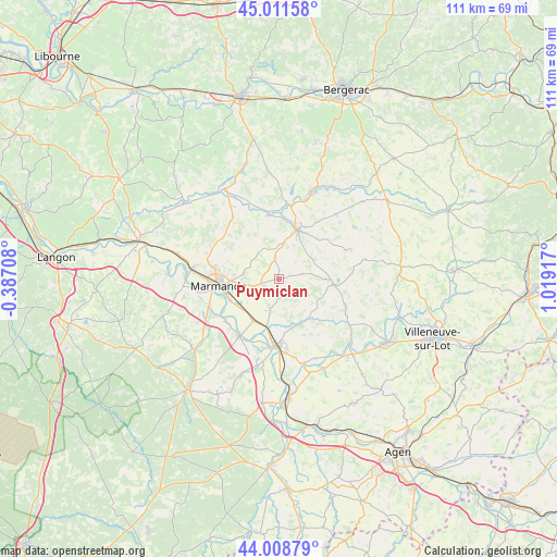
Puymiclan GPS coordinates[2]
44° 30' 44.424" North, 0° 18' 57.78" East
| Map corner | latitude | longitude |
|---|---|---|
| Upper-left | 45.01158°, | -0.38708° |
| Center: | 44.51234°, | 0.31605° |
| Lower-right: | 44.00879°, | 1.01917° |
| Map W x H: | 111.5×111.5 km | = 69.3×69.3mi |
| max Lat: | 51.07786° ⇑83.5% North |
| Puymiclan: | 44.51234° |
| min Lat: | ⇓16.5% South 41.3874° |
| min Long | Puymiclan | max Long |
| -5.08615° | 0.31605° | 9.52242° |
| W 24.8%⇐ | ⇒75.2% E |
Elevation
Elevation of Puymiclan is 85 m = 279 ft, and this is 108.7 m = 357 ft below average elevation for this country.
| Max E: |
2333 m = 7654 ft | 67% |
| Avg. | 193.7 m = 635 ft | |
| Puymiclan | 85 m = 279 ft | |
Min E: |
-1 m = -3 ft | 33% |
See also: France elevation on elevation.city.
Geographical zone
Puymiclan is located in North temperate zone (between Tropic of Cancer and the Arctic Circle). Distance of this Northern Tropic circle is 2343.4 km =1456.1 mi to South.| Distance of | km | miles | from Puymiclan |
|---|---|---|---|
| North Pole | 5057.8 | 3142.8 | to North |
| Arctic Circle | 2451.9 | 1523.5 | to North |
| Tropic Cancer | 2343.4 | 1456.1 | to South |
| Equator | 4949.3 | 3075.4 | to South |


Nearby cities:
15 places around Puymiclan: (largest is in red/bold)
• Birac-sur-Trec
4.9 km =3 mi,  232°
232°
• Escassefort
7.3 km =4.5 mi,  302°
302°
• Fauguerolles
9.4 km =5.8 mi,  213°
213°
• Fauillet
9.8 km =6.1 mi,  191°
191°
• Fongrave
7.1 km =4.4 mi,  70°
70°
• Gontaud-de-Nogaret
7 km =4.3 mi, 190°
• Lavergne
10.9 km =6.8 mi,  36°
36°
• Marmande
12 km =7.5 mi,  263°
263°
• Miramont-de-Guyenne
10.6 km =6.6 mi,  20°
20°
• Roumagne
11.9 km =7.4 mi,  8°
8°
• Saint-Pardoux-Isaac
12 km =7.5 mi, 22°
• Saint-Pardoux-du-Breuil
10.5 km =6.5 mi,  247°
247°
• Seyches
4.4 km =2.7 mi,  350°
350°
• Varès
9.8 km =6.1 mi,  159°
159°
• Virazeil
7.5 km =4.7 mi,  265°
265°
Sources, notices
• [Note1] Compared only with cities in France existing in our database
• [Src1] Map data: © OpenStreetMap contributors (CC-BY-SA)
• [Src2] Other city data from geonames.org with taken over terms of usage.
• [Src3] Geographical zone / Annual Mean Temperature by Robert A. Rohde @ Wikipedia
