Ville-sur-Jarnioux geodata
Ville-sur-Jarnioux (Auvergne-Rhône-Alpes) is a populated place; located in France in Europe/Paris (GMT+2) time zone. With population of 686 people, there are 12000 cities with bigger population in this country. Compared to other cities in France, 66.7% of cities are located further ↑North; 72.9% of cities are located further ←West and 89.5% of cities have lower elevation than Ville-sur-Jarnioux. Note1
Administrative division(s):
- Level 1: Auvergne-Rhône-Alpes
- Level 2: Département du Rhône
- Level 3: Arrondissement de Villefranche-sur-Saône
- Level 4: Ville-sur-Jarnioux


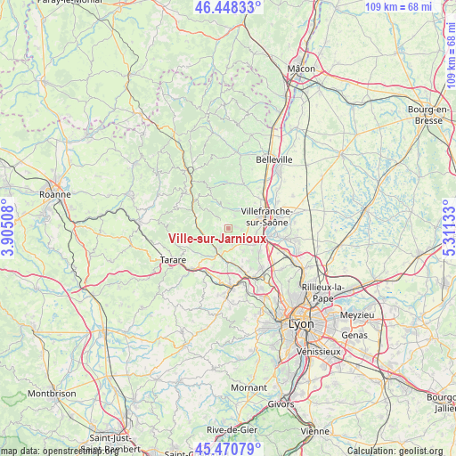
Ville-sur-Jarnioux GPS coordinates[2]
45° 57' 42.192" North, 4° 36' 29.52" East
| Map corner | latitude | longitude |
|---|---|---|
| Upper-left | 46.44833°, | 3.90508° |
| Center: | 45.96172°, | 4.6082° |
| Lower-right: | 45.47079°, | 5.31133° |
| Map W x H: | 108.7×108.7 km | = 67.5×67.5mi |
| max Lat: | 51.07786° ⇑66.7% North |
| Ville-sur-Jarnioux: | 45.96172° |
| min Lat: | ⇓33.3% South 41.3874° |
| min Long | Ville-sur-Jarni | max Long |
| -5.08615° | 4.6082° | 9.52242° |
| W 72.9%⇐ | ⇒27.1% E |
Elevation
Elevation of Ville-sur-Jarnioux is 415 m = 1362 ft, and this is 221.3 m = 726 ft above average elevation for this country.
| Max E: |
2333 m = 7654 ft | 10.5% |
| Ville-sur-Jarnioux | 415 m 1362 ft | |
| Avg. | 193.7 m = 635 ft | |
Min E: |
-1 m = -3 ft | 89.5% |
See also: France elevation on elevation.city.
Geographical zone
Ville-sur-Jarnioux is located in North temperate zone (between Tropic of Cancer and the Arctic Circle). Distance of this North polar circle is 2290.7 km =1423.4 mi to North.| Distance of | km | miles | from Ville-sur-Jarnioux |
|---|---|---|---|
| North Pole | 4896.6 | 3042.6 | to North |
| Arctic Circle | 2290.7 | 1423.4 | to North |
| Tropic Cancer | 2504.5 | 1556.2 | to South |
| Equator | 5110.5 | 3175.5 | to South |


Nearby cities:
15 places around Ville-sur-Jarnioux: (largest is in red/bold)
• Alix
6.5 km =4 mi,  146°
146°
• Bagnols
4.9 km =3 mi,  180°
180°
• Cogny
3.1 km =1.9 mi,  24°
24°
• Denicé
5.3 km =3.3 mi,  33°
33°
• Frontenas
4.1 km =2.5 mi,  169°
169°
• Jarnioux
1.5 km =0.9 mi,  77°
77°
• Lacenas
4 km =2.5 mi,  44°
44°
• Le Bois-d'Oingt
5.3 km =3.3 mi,  201°
201°
• Liergues
4.3 km =2.7 mi, 75°
• Oingt
2.4 km =1.5 mi,  233°
233°
• Pouilly-le-Monial
3 km =1.9 mi,  99°
99°
• Rivolet
4.9 km =3 mi,  354°
354°
• Saint-Laurent-d’Oingt
4 km =2.5 mi,  240°
240°
• Ternand
6.4 km =4 mi,  252°
252°
• Theizé
2.5 km =1.6 mi, 165°
Sources, notices
• [Note1] Compared only with cities in France existing in our database
• [Src1] Map data: © OpenStreetMap contributors (CC-BY-SA)
• [Src2] Other city data from geonames.org with taken over terms of usage.
• [Src3] Geographical zone / Annual Mean Temperature by Robert A. Rohde @ Wikipedia
