Villelaure geodata
Villelaure (Provence-Alpes-Côte d'Azur) is a populated place; located in France in Europe/Paris (GMT+2) time zone. With population of 3,132 people, there are 3110 cities with bigger population in this country. Compared to other cities in France, 90.3% of cities are located further ↑North; 82.3% of cities are located further ←West and 75.4% of cities have lower elevation than Villelaure. Note1
Administrative division(s):
- Level 1: Provence-Alpes-Côte d'Azur
- Level 2: Département du Vaucluse
- Level 3: Apt
- Level 4: Villelaure


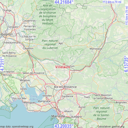
Villelaure GPS coordinates[2]
43° 42' 38.7" North, 5° 26' 3.192" East
| Map corner | latitude | longitude |
|---|---|---|
| Upper-left | 44.21684°, | 4.7311° |
| Center: | 43.71075°, | 5.43422° |
| Lower-right: | 43.20035°, | 6.13735° |
| Map W x H: | 113×113 km | = 70.2×70.2mi |
| max Lat: | 51.07786° ⇑90.3% North |
| Villelaure: | 43.71075° |
| min Lat: | ⇓9.7% South 41.3874° |
| min Long | Villelaure | max Long |
| -5.08615° | 5.43422° | 9.52242° |
| W 82.3%⇐ | ⇒17.7% E |
Elevation
Elevation of Villelaure is 252 m = 827 ft, and this is 58.3 m = 191 ft above average elevation for this country.
| Max E: |
2333 m = 7654 ft | 24.6% |
| Villelaure | 252 m 827 ft | |
| Avg. | 193.7 m = 635 ft | |
Min E: |
-1 m = -3 ft | 75.4% |
See also: France elevation on elevation.city.
Geographical zone
Villelaure is located in North temperate zone (between Tropic of Cancer and the Arctic Circle). Distance of this Northern Tropic circle is 2254.3 km =1400.8 mi to South.| Distance of | km | miles | from Villelaure |
|---|---|---|---|
| North Pole | 5146.9 | 3198.1 | to North |
| Arctic Circle | 2541 | 1578.9 | to North |
| Tropic Cancer | 2254.3 | 1400.8 | to South |
| Equator | 4860.2 | 3020 | to South |


Nearby cities:
15 places around Villelaure: (largest is in red/bold)
• Ansouis
3.8 km =2.4 mi,  38°
38°
• Cadenet
5.6 km =3.5 mi,  298°
298°
• Cucuron
6.9 km =4.3 mi,  2°
2°
• Grambois
13.7 km =8.5 mi,  65°
65°
• La Bastidonne
10.8 km =6.7 mi,  95°
95°
• La Roque-d’Anthéron
10 km =6.2 mi,  272°
272°
• Lauris
10.5 km =6.5 mi,  292°
292°
• Le Puy-Sainte-Réparade
5.2 km =3.2 mi,  179°
179°
• Lourmarin
8.2 km =5.1 mi,  315°
315°
• Meyrargues
11.1 km =6.9 mi,  137°
137°
• Pertuis
5.8 km =3.6 mi,  108°
108°
• Puyvert
9.3 km =5.8 mi,  305°
305°
• Rognes
8.7 km =5.4 mi,  233°
233°
• Saint-Martin-de-la-Brasque
10.5 km =6.5 mi,  51°
51°
• Venelles
13 km =8.1 mi,  163°
163°
Sources, notices
• [Note1] Compared only with cities in France existing in our database
• [Src1] Map data: © OpenStreetMap contributors (CC-BY-SA)
• [Src2] Other city data from geonames.org with taken over terms of usage.
• [Src3] Geographical zone / Annual Mean Temperature by Robert A. Rohde @ Wikipedia
