Venelles geodata
Venelles (Provence-Alpes-Côte d'Azur) is a populated place; located in France in Europe/Paris (GMT+2) time zone. With population of 7,917 people, there are 1223 cities with bigger population in this country. Compared to other cities in France, 91.9% of cities are located further ↑North; 82.7% of cities are located further ←West and 86% of cities have lower elevation than Venelles. Note1
Administrative division(s):
- Level 1: Provence-Alpes-Côte d'Azur
- Level 2: Département des Bouches-du-Rhône
- Level 3: Aix-en-Provence
- Level 4: Venelles


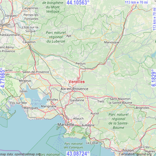
Venelles GPS coordinates[2]
43° 35' 54.924" North, 5° 28' 47.172" East
| Map corner | latitude | longitude |
|---|---|---|
| Upper-left | 44.10563°, | 4.77665° |
| Center: | 43.59859°, | 5.47977° |
| Lower-right: | 43.08724°, | 6.1829° |
| Map W x H: | 113.2×113.2 km | = 70.3×70.3mi |
| max Lat: | 51.07786° ⇑91.9% North |
| Venelles: | 43.59859° |
| min Lat: | ⇓8.1% South 41.3874° |
| min Long | Venelles | max Long |
| -5.08615° | 5.47977° | 9.52242° |
| W 82.7%⇐ | ⇒17.3% E |
Elevation
Elevation of Venelles is 360 m = 1181 ft, and this is 166.3 m = 546 ft above average elevation for this country.
| Max E: |
2333 m = 7654 ft | 14% |
| Venelles | 360 m 1181 ft | |
| Avg. | 193.7 m = 635 ft | |
Min E: |
-1 m = -3 ft | 86% |
See also: France elevation on elevation.city.
Geographical zone
Venelles is located in North temperate zone (between Tropic of Cancer and the Arctic Circle). Distance of this Northern Tropic circle is 2241.8 km =1393 mi to South.| Distance of | km | miles | from Venelles |
|---|---|---|---|
| North Pole | 5159.4 | 3205.9 | to North |
| Arctic Circle | 2553.5 | 1586.7 | to North |
| Tropic Cancer | 2241.8 | 1393 | to South |
| Equator | 4847.7 | 3012.2 | to South |


Nearby cities:
15 places around Venelles: (largest is in red/bold)
• Aix-en-Provence
8.2 km =5.1 mi,  197°
197°
• Beaurecueil
11 km =6.8 mi,  151°
151°
• Jouques
13.3 km =8.3 mi,  71°
71°
• La Bastidonne
13.4 km =8.3 mi,  31°
31°
• Le Puy-Sainte-Réparade
8.1 km =5 mi,  333°
333°
• Le Tholonet
8.9 km =5.5 mi,  163°
163°
• Meyrargues
5.7 km =3.5 mi,  41°
41°
• Meyreuil
12.4 km =7.7 mi,  174°
174°
• Pertuis
10.8 km =6.7 mi,  9°
9°
• Peyrolles-en-Provence
9.9 km =6.2 mi,  58°
58°
• Rognes
12.9 km =8 mi,  304°
304°
• Saint-Marc-Jaumegarde
6.7 km =4.2 mi, 148°
• Vauvenargues
10.7 km =6.6 mi,  116°
116°
• Villelaure
13 km =8.1 mi,  343°
343°
• Éguilles
10.5 km =6.5 mi,  251°
251°
Sources, notices
• [Note1] Compared only with cities in France existing in our database
• [Src1] Map data: © OpenStreetMap contributors (CC-BY-SA)
• [Src2] Other city data from geonames.org with taken over terms of usage.
• [Src3] Geographical zone / Annual Mean Temperature by Robert A. Rohde @ Wikipedia
