La Roque-d’Anthéron geodata
La Roque-d’Anthéron (Provence-Alpes-Côte d'Azur) is a populated place; located in France in Europe/Paris (GMT+2) time zone. With population of 5,469 people, there are 1807 cities with bigger population in this country. Compared to other cities in France, 90.2% of cities are located further ↑North; 80.7% of cities are located further ←West and 59.6% of cities have lower elevation than La Roque-d’Anthéron. Note1
Administrative division(s):
- Level 1: Provence-Alpes-Côte d'Azur
- Level 2: Département des Bouches-du-Rhône
- Level 3: Aix-en-Provence
- Level 4: La Roque-d'Anthéron


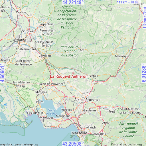
La Roque-d’Anthéron GPS coordinates[2]
43° 42' 55.584" North, 5° 18' 35.028" East
| Map corner | latitude | longitude |
|---|---|---|
| Upper-left | 44.22149°, | 4.60661° |
| Center: | 43.71544°, | 5.30973° |
| Lower-right: | 43.20508°, | 6.01286° |
| Map W x H: | 113×113 km | = 70.2×70.2mi |
| max Lat: | 51.07786° ⇑90.2% North |
| La Roque-d’Anthéron: | 43.71544° |
| min Lat: | ⇓9.8% South 41.3874° |
| min Long | La Roque-d’An | max Long |
| -5.08615° | 5.30973° | 9.52242° |
| W 80.7%⇐ | ⇒19.3% E |
Elevation
Elevation of La Roque-d’Anthéron is 168 m = 551 ft, and this is 25.7 m = 84 ft below average elevation for this country.
| Max E: |
2333 m = 7654 ft | 40.4% |
| Avg. | 193.7 m = 635 ft | |
| La Roque-d’Anthéron | 168 m = 551 ft | |
Min E: |
-1 m = -3 ft | 59.6% |
See also: France elevation on elevation.city.
Geographical zone
La Roque-d’Anthéron is located in North temperate zone (between Tropic of Cancer and the Arctic Circle). Distance of this Northern Tropic circle is 2254.8 km =1401.1 mi to South.| Distance of | km | miles | from La Roque-d’Anthéron |
|---|---|---|---|
| North Pole | 5146.4 | 3197.8 | to North |
| Arctic Circle | 2540.5 | 1578.6 | to North |
| Tropic Cancer | 2254.8 | 1401.1 | to South |
| Equator | 4860.7 | 3020.3 | to South |


Nearby cities:
15 places around La Roque-d’Anthéron: (largest is in red/bold)
• Alleins
11.9 km =7.4 mi,  263°
263°
• Cadenet
5.6 km =3.5 mi,  66°
66°
• Charleval
5.2 km =3.2 mi,  273°
273°
• Lambesc
7.8 km =4.8 mi,  209°
209°
• Lauris
3.5 km =2.2 mi,  4°
4°
• Le Puy-Sainte-Réparade
11.6 km =7.2 mi,  119°
119°
• Lourmarin
6.9 km =4.3 mi,  38°
38°
• Mallemort
10.6 km =6.6 mi,  279°
279°
• Mérindol
9.6 km =6 mi,  297°
297°
• Puget
5.5 km =3.4 mi,  323°
323°
• Puyvert
5.5 km =3.4 mi,  27°
27°
• Rognes
6.5 km =4 mi,  152°
152°
• Saint-Cannat
10.5 km =6.5 mi,  185°
185°
• Vernègues
11.6 km =7.2 mi,  253°
253°
• Villelaure
10 km =6.2 mi,  92°
92°
Sources, notices
• [Note1] Compared only with cities in France existing in our database
• [Src1] Map data: © OpenStreetMap contributors (CC-BY-SA)
• [Src2] Other city data from geonames.org with taken over terms of usage.
• [Src3] Geographical zone / Annual Mean Temperature by Robert A. Rohde @ Wikipedia
