Villegly geodata
Villegly (Occitanie) is a populated place; located in France in Europe/Paris (GMT+2) time zone. With population of 802 people, there are 10583 cities with bigger population in this country. Compared to other cities in France, 96% of cities are located further ↑North; 50.4% of cities are located further →East and 53.6% of cities have lower elevation than Villegly. Note1
Administrative division(s):
- Level 1: Occitanie
- Level 2: Département de l'Aude
- Level 3: Arrondissement de Carcassonne
- Level 4: Villegly


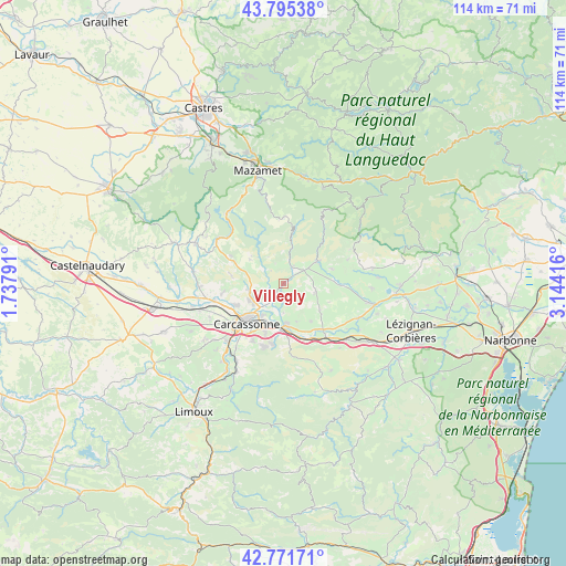
Villegly GPS coordinates[2]
43° 17' 8.52" North, 2° 26' 27.744" East
| Map corner | latitude | longitude |
|---|---|---|
| Upper-left | 43.79538°, | 1.73791° |
| Center: | 43.2857°, | 2.44104° |
| Lower-right: | 42.77171°, | 3.14416° |
| Map W x H: | 113.8×113.8 km | = 70.7×70.7mi |
| max Lat: | 51.07786° ⇑96% North |
| Villegly: | 43.2857° |
| min Lat: | ⇓4% South 41.3874° |
| min Long | Villegly | max Long |
| -5.08615° | 2.44104° | 9.52242° |
| W 49.6%⇐ | ⇒50.4% E |
Elevation
Elevation of Villegly is 145 m = 476 ft, and this is 48.7 m = 160 ft below average elevation for this country.
| Max E: |
2333 m = 7654 ft | 46.4% |
| Avg. | 193.7 m = 635 ft | |
| Villegly | 145 m = 476 ft | |
Min E: |
-1 m = -3 ft | 53.6% |
See also: France elevation on elevation.city.
Geographical zone
Villegly is located in North temperate zone (between Tropic of Cancer and the Arctic Circle). Distance of this Northern Tropic circle is 2207 km =1371.4 mi to South.| Distance of | km | miles | from Villegly |
|---|---|---|---|
| North Pole | 5194.1 | 3227.5 | to North |
| Arctic Circle | 2588.3 | 1608.3 | to North |
| Tropic Cancer | 2207 | 1371.4 | to South |
| Equator | 4812.9 | 2990.6 | to South |


Nearby cities:
15 places around Villegly: (largest is in red/bold)
• Badens
9.2 km =5.7 mi,  143°
143°
• Berriac
8.5 km =5.3 mi,  196°
196°
• Carcassonne
10.8 km =6.7 mi,  222°
222°
• Caunes-Minervois
8.1 km =5 mi,  57°
57°
• Conques-sur-Orbiel
2.9 km =1.8 mi, 222°
• Laure-Minervois
6.6 km =4.1 mi,  104°
104°
• Malves-en-Minervois
4 km =2.5 mi,  169°
169°
• Pennautier
10.9 km =6.8 mi,  245°
245°
• Peyriac-Minervois
10.1 km =6.3 mi,  86°
86°
• Rieux-Minervois
11.8 km =7.3 mi, 92°
• Trèbes
8.3 km =5.2 mi,  179°
179°
• Villalier
4 km =2.5 mi, 215°
• Villegailhenc
7.2 km =4.5 mi, 254°
• Villemoustaussou
7.2 km =4.5 mi,  238°
238°
• Villeneuve-Minervois
3.7 km =2.3 mi,  27°
27°
Sources, notices
• [Note1] Compared only with cities in France existing in our database
• [Src1] Map data: © OpenStreetMap contributors (CC-BY-SA)
• [Src2] Other city data from geonames.org with taken over terms of usage.
• [Src3] Geographical zone / Annual Mean Temperature by Robert A. Rohde @ Wikipedia
