Pennautier geodata
Pennautier (Occitanie) is a populated place; located in France in Europe/Paris (GMT+2) time zone. With population of 2,409 people, there are 4014 cities with bigger population in this country. Compared to other cities in France, 96.7% of cities are located further ↑North; 52.4% of cities are located further →East and 54.8% of cities have higher elevation than Pennautier. Note1
Administrative division(s):
- Level 1: Occitanie
- Level 2: Département de l'Aude
- Level 3: Arrondissement de Carcassonne
- Level 4: Pennautier


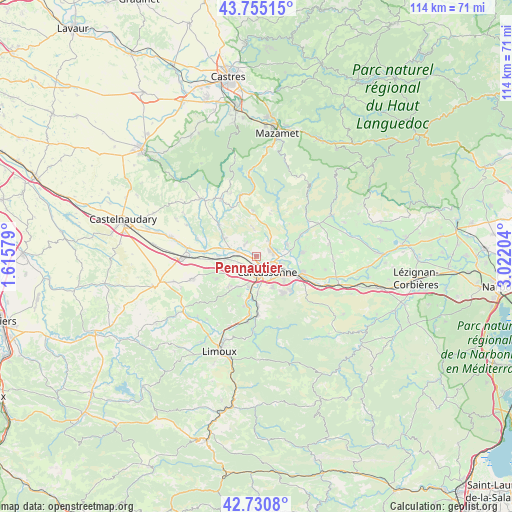
Pennautier GPS coordinates[2]
43° 14' 42.468" North, 2° 19' 8.112" East
| Map corner | latitude | longitude |
|---|---|---|
| Upper-left | 43.75515°, | 1.61579° |
| Center: | 43.24513°, | 2.31892° |
| Lower-right: | 42.7308°, | 3.02204° |
| Map W x H: | 113.9×113.9 km | = 70.8×70.8mi |
| max Lat: | 51.07786° ⇑96.7% North |
| Pennautier: | 43.24513° |
| min Lat: | ⇓3.3% South 41.3874° |
| min Long | Pennautier | max Long |
| -5.08615° | 2.31892° | 9.52242° |
| W 47.6%⇐ | ⇒52.4% E |
Elevation
Elevation of Pennautier is 117 m = 384 ft, and this is 76.7 m = 252 ft below average elevation for this country.
| Max E: |
2333 m = 7654 ft | 54.8% |
| Avg. | 193.7 m = 635 ft | |
| Pennautier | 117 m = 384 ft | |
Min E: |
-1 m = -3 ft | 45.2% |
See also: France elevation on elevation.city.
Geographical zone
Pennautier is located in North temperate zone (between Tropic of Cancer and the Arctic Circle). Distance of this Northern Tropic circle is 2202.5 km =1368.6 mi to South.| Distance of | km | miles | from Pennautier |
|---|---|---|---|
| North Pole | 5198.7 | 3230.3 | to North |
| Arctic Circle | 2592.8 | 1611.1 | to North |
| Tropic Cancer | 2202.5 | 1368.6 | to South |
| Equator | 4808.4 | 2987.8 | to South |


Nearby cities:
15 places around Pennautier: (largest is in red/bold)
• Alairac
9.2 km =5.7 mi,  223°
223°
• Berriac
8.3 km =5.2 mi,  115°
115°
• Carcassonne
4.4 km =2.7 mi,  143°
143°
• Caux-et-Sauzens
5.6 km =3.5 mi,  246°
246°
• Cavanac
8.6 km =5.3 mi,  175°
175°
• Cazilhac
7.8 km =4.8 mi,  154°
154°
• Conques-sur-Orbiel
8.3 km =5.2 mi,  73°
73°
• Lavalette
7.9 km =4.9 mi,  211°
211°
• Moussoulens
8 km =5 mi,  299°
299°
• Pezens
4.2 km =2.6 mi,  284°
284°
• Ventenac-Cabardès
3.6 km =2.2 mi,  310°
310°
• Villalier
7.7 km =4.8 mi,  80°
80°
• Villegailhenc
3.9 km =2.4 mi,  47°
47°
• Villemoustaussou
3.8 km =2.4 mi, 78°
• Villesèquelande
7.1 km =4.4 mi,  259°
259°
Sources, notices
• [Note1] Compared only with cities in France existing in our database
• [Src1] Map data: © OpenStreetMap contributors (CC-BY-SA)
• [Src2] Other city data from geonames.org with taken over terms of usage.
• [Src3] Geographical zone / Annual Mean Temperature by Robert A. Rohde @ Wikipedia
