Villegailhenc geodata
Villegailhenc (Occitanie) is a populated place; located in France in Europe/Paris (GMT+2) time zone. With population of 1,517 people, there are 6130 cities with bigger population in this country. Compared to other cities in France, 96.3% of cities are located further ↑North; 51.7% of cities are located further →East and 50.5% of cities have higher elevation than Villegailhenc. Note1
Administrative division(s):
- Level 1: Occitanie
- Level 2: Département de l'Aude
- Level 3: Arrondissement de Carcassonne
- Level 4: Villegailhenc


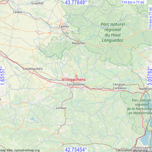
Villegailhenc GPS coordinates[2]
43° 16' 7.212" North, 2° 21' 16.884" East
| Map corner | latitude | longitude |
|---|---|---|
| Upper-left | 43.77849°, | 1.65157° |
| Center: | 43.26867°, | 2.35469° |
| Lower-right: | 42.75454°, | 3.05782° |
| Map W x H: | 113.9×113.9 km | = 70.8×70.8mi |
| max Lat: | 51.07786° ⇑96.3% North |
| Villegailhenc: | 43.26867° |
| min Lat: | ⇓3.7% South 41.3874° |
| min Long | Villegailhenc | max Long |
| -5.08615° | 2.35469° | 9.52242° |
| W 48.3%⇐ | ⇒51.7% E |
Elevation
Elevation of Villegailhenc is 130 m = 427 ft, and this is 63.7 m = 209 ft below average elevation for this country.
| Max E: |
2333 m = 7654 ft | 50.5% |
| Avg. | 193.7 m = 635 ft | |
| Villegailhenc | 130 m = 427 ft | |
Min E: |
-1 m = -3 ft | 49.5% |
See also: France elevation on elevation.city.
Geographical zone
Villegailhenc is located in North temperate zone (between Tropic of Cancer and the Arctic Circle). Distance of this Northern Tropic circle is 2205.1 km =1370.2 mi to South.| Distance of | km | miles | from Villegailhenc |
|---|---|---|---|
| North Pole | 5196 | 3228.6 | to North |
| Arctic Circle | 2590.1 | 1609.4 | to North |
| Tropic Cancer | 2205.1 | 1370.2 | to South |
| Equator | 4811 | 2989.4 | to South |


Nearby cities:
15 places around Villegailhenc: (largest is in red/bold)
• Berriac
7.7 km =4.8 mi,  143°
143°
• Carcassonne
6.1 km =3.8 mi,  182°
182°
• Caux-et-Sauzens
9.3 km =5.8 mi,  238°
238°
• Cazilhac
9.6 km =6 mi, 177°
• Conques-sur-Orbiel
5 km =3.1 mi,  92°
92°
• Malves-en-Minervois
8 km =5 mi,  105°
105°
• Moussoulens
10 km =6.2 mi,  277°
277°
• Pennautier
3.9 km =2.4 mi,  227°
227°
• Pezens
7.1 km =4.4 mi,  257°
257°
• Trèbes
9.6 km =6 mi,  132°
132°
• Ventenac-Cabardès
5.7 km =3.5 mi,  267°
267°
• Villalier
4.8 km =3 mi, 106°
• Villegly
7.2 km =4.5 mi,  74°
74°
• Villemoustaussou
2.1 km =1.3 mi,  154°
154°
• Villeneuve-Minervois
10.1 km =6.3 mi,  59°
59°
Sources, notices
• [Note1] Compared only with cities in France existing in our database
• [Src1] Map data: © OpenStreetMap contributors (CC-BY-SA)
• [Src2] Other city data from geonames.org with taken over terms of usage.
• [Src3] Geographical zone / Annual Mean Temperature by Robert A. Rohde @ Wikipedia
