Vignieu geodata
Vignieu (Auvergne-Rhône-Alpes) is a populated place; located in France in Europe/Paris (GMT+2) time zone. With population of 804 people, there are 10564 cities with bigger population in this country. Compared to other cities in France, 72% of cities are located further ↑North; 82.2% of cities are located further ←West and 73% of cities have lower elevation than Vignieu. Note1
Administrative division(s):
- Level 1: Auvergne-Rhône-Alpes
- Level 2: Département de l'Isère
- Level 3: Arrondissement de La Tour-du-Pin
- Level 4: Vignieu


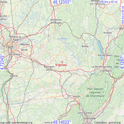
Vignieu GPS coordinates[2]
45° 38' 2.508" North, 5° 25' 35.652" East
| Map corner | latitude | longitude |
|---|---|---|
| Upper-left | 46.12353°, | 4.72345° |
| Center: | 45.63403°, | 5.42657° |
| Lower-right: | 45.14022°, | 6.1297° |
| Map W x H: | 109.3×109.3 km | = 67.9×67.9mi |
| max Lat: | 51.07786° ⇑72% North |
| Vignieu: | 45.63403° |
| min Lat: | ⇓28% South 41.3874° |
| min Long | Vignieu | max Long |
| -5.08615° | 5.42657° | 9.52242° |
| W 82.2%⇐ | ⇒17.8% E |
Elevation
Elevation of Vignieu is 236 m = 774 ft, and this is 42.3 m = 139 ft above average elevation for this country.
| Max E: |
2333 m = 7654 ft | 27% |
| Vignieu | 236 m 774 ft | |
| Avg. | 193.7 m = 635 ft | |
Min E: |
-1 m = -3 ft | 73% |
See also: France elevation on elevation.city.
Geographical zone
Vignieu is located in North temperate zone (between Tropic of Cancer and the Arctic Circle). Distance of this North polar circle is 2327.1 km =1446 mi to North.| Distance of | km | miles | from Vignieu |
|---|---|---|---|
| North Pole | 4933 | 3065.2 | to North |
| Arctic Circle | 2327.1 | 1446 | to North |
| Tropic Cancer | 2468.1 | 1533.6 | to South |
| Equator | 5074 | 3152.8 | to South |


Nearby cities:
15 places around Vignieu: (largest is in red/bold)
• Curtin
5 km =3.1 mi,  77°
77°
• Dolomieu
5.6 km =3.5 mi,  124°
124°
• La Chapelle-de-la-Tour
6.2 km =3.9 mi,  152°
152°
• La Tour-du-Pin
7.7 km =4.8 mi,  169°
169°
• Le Bouchage
8.5 km =5.3 mi,  59°
59°
• Morestel
5.8 km =3.6 mi,  30°
30°
• Passins
6 km =3.7 mi,  2°
2°
• Rochetoirin
5.7 km =3.5 mi,  191°
191°
• Saint-Chef
4.8 km =3 mi,  272°
272°
• Saint-Clair-de-la-Tour
7.8 km =4.8 mi, 149°
• Saint-Jean-de-Soudain
7.4 km =4.6 mi,  178°
178°
• Saint-Sorlin-de-Morestel
4.2 km =2.6 mi, 84°
• Salagnon
6.2 km =3.9 mi,  308°
308°
• Sermérieu
4.2 km =2.6 mi,  343°
343°
• Thuellin
6.4 km =4 mi, 84°
Sources, notices
• [Note1] Compared only with cities in France existing in our database
• [Src1] Map data: © OpenStreetMap contributors (CC-BY-SA)
• [Src2] Other city data from geonames.org with taken over terms of usage.
• [Src3] Geographical zone / Annual Mean Temperature by Robert A. Rohde @ Wikipedia
