Morestel geodata
Morestel (Auvergne-Rhône-Alpes) is a populated place; located in France in Europe/Paris (GMT+2) time zone. With population of 3,307 people, there are 2951 cities with bigger population in this country. Compared to other cities in France, 71.2% of cities are located further ↑North; 82.6% of cities are located further ←West and 71.6% of cities have lower elevation than Morestel. Note1
Administrative division(s):
- Level 1: Auvergne-Rhône-Alpes
- Level 2: Département de l'Isère
- Level 3: Arrondissement de La Tour-du-Pin
- Level 4: Morestel


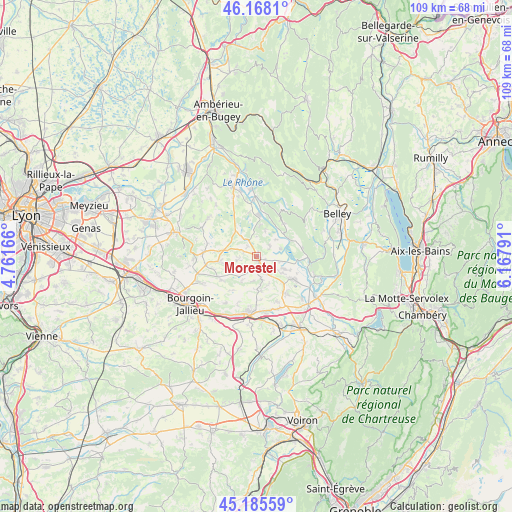
Morestel GPS coordinates[2]
45° 40' 44.4" North, 5° 27' 53.244" East
| Map corner | latitude | longitude |
|---|---|---|
| Upper-left | 46.1681°, | 4.76166° |
| Center: | 45.679°, | 5.46479° |
| Lower-right: | 45.18559°, | 6.16791° |
| Map W x H: | 109.2×109.2 km | = 67.9×67.9mi |
| max Lat: | 51.07786° ⇑71.2% North |
| Morestel: | 45.679° |
| min Lat: | ⇓28.8% South 41.3874° |
| min Long | Morestel | max Long |
| -5.08615° | 5.46479° | 9.52242° |
| W 82.6%⇐ | ⇒17.4% E |
Elevation
Elevation of Morestel is 227 m = 745 ft, and this is 33.3 m = 109 ft above average elevation for this country.
| Max E: |
2333 m = 7654 ft | 28.4% |
| Morestel | 227 m 745 ft | |
| Avg. | 193.7 m = 635 ft | |
Min E: |
-1 m = -3 ft | 71.6% |
See also: France elevation on elevation.city.
Geographical zone
Morestel is located in North temperate zone (between Tropic of Cancer and the Arctic Circle). Distance of this North polar circle is 2322.1 km =1442.9 mi to North.| Distance of | km | miles | from Morestel |
|---|---|---|---|
| North Pole | 4928 | 3062.1 | to North |
| Arctic Circle | 2322.1 | 1442.9 | to North |
| Tropic Cancer | 2473.1 | 1536.7 | to South |
| Equator | 5079 | 3155.9 | to South |


Nearby cities:
15 places around Morestel: (largest is in red/bold)
• Brangues
5.4 km =3.4 mi,  72°
72°
• Courtenay
8.5 km =5.3 mi,  309°
309°
• Creys-Mépieu
6.2 km =3.9 mi,  13°
13°
• Curtin
4.4 km =2.7 mi,  153°
153°
• Dolomieu
8.3 km =5.2 mi,  168°
168°
• Le Bouchage
4.4 km =2.7 mi,  99°
99°
• Les Avenières
8.9 km =5.5 mi,  122°
122°
• Lhuis
9.1 km =5.7 mi,  39°
39°
• Passins
2.9 km =1.8 mi,  290°
290°
• Saint-Sorlin-de-Morestel
4.8 km =3 mi, 165°
• Saint-Victor-de-Morestel
3.6 km =2.2 mi,  49°
49°
• Salagnon
8 km =5 mi,  261°
261°
• Sermérieu
4.3 km =2.7 mi, 256°
• Thuellin
5.5 km =3.4 mi,  142°
142°
• Vignieu
5.8 km =3.6 mi,  210°
210°
Sources, notices
• [Note1] Compared only with cities in France existing in our database
• [Src1] Map data: © OpenStreetMap contributors (CC-BY-SA)
• [Src2] Other city data from geonames.org with taken over terms of usage.
• [Src3] Geographical zone / Annual Mean Temperature by Robert A. Rohde @ Wikipedia
