Vern-d’Anjou geodata
Vern-d’Anjou (Pays de la Loire) is a populated place; located in France in Europe/Paris (GMT+2) time zone. With population of 2,071 people, there are 4638 cities with bigger population in this country. Compared to other cities in France, 52.7% of cities are located further ↓South; 86.7% of cities are located further →East and 83.4% of cities have higher elevation than Vern-d’Anjou. Note1
Administrative division(s):
- Level 1: Pays de la Loire
- Level 2: Département de Maine-et-Loire
- Level 3: Arrondissement de Segré
- Level 4: Erdre-en-Anjou


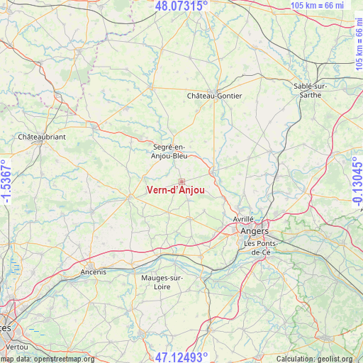
Vern-d’Anjou GPS coordinates[2]
47° 36' 4.284" North, 0° 50' 0.852" West
| Map corner | latitude | longitude |
|---|---|---|
| Upper-left | 48.07315°, | -1.5367° |
| Center: | 47.60119°, | -0.83357° |
| Lower-right: | 47.12493°, | -0.13045° |
| Map W x H: | 105.4×105.4 km | = 65.5×65.5mi |
| max Lat: | 51.07786° ⇑47.3% North |
| Vern-d’Anjou: | 47.60119° |
| min Lat: | ⇓52.7% South 41.3874° |
| min Long | Vern-d’Anjou | max Long |
| -5.08615° | -0.83357° | 9.52242° |
| W 13.3%⇐ | ⇒86.7% E |
Elevation
Elevation of Vern-d’Anjou is 46 m = 151 ft, and this is 147.7 m = 485 ft below average elevation for this country.
| Max E: |
2333 m = 7654 ft | 83.4% |
| Avg. | 193.7 m = 635 ft | |
| Vern-d’Anjou | 46 m = 151 ft | |
Min E: |
-1 m = -3 ft | 16.6% |
See also: France elevation on elevation.city.
Geographical zone
Vern-d’Anjou is located in North temperate zone (between Tropic of Cancer and the Arctic Circle). Distance of this North polar circle is 2108.4 km =1310.1 mi to North.| Distance of | km | miles | from Vern-d’Anjou |
|---|---|---|---|
| North Pole | 4714.3 | 2929.3 | to North |
| Arctic Circle | 2108.4 | 1310.1 | to North |
| Tropic Cancer | 2686.8 | 1669.5 | to South |
| Equator | 5292.8 | 3288.8 | to South |


Nearby cities:
15 places around Vern-d’Anjou: (largest is in red/bold)
• Angrie
11 km =6.8 mi,  251°
251°
• Brain-sur-Longuenée
5.7 km =3.5 mi,  108°
108°
• Bécon-les-Granits
11.4 km =7.1 mi,  167°
167°
• Chazé-sur-Argos
4.7 km =2.9 mi,  293°
293°
• Grez-Neuville
11.4 km =7.1 mi,  89°
89°
• La Chapelle-sur-Oudon
8.5 km =5.3 mi,  3°
3°
• La Membrolle-sur-Longuenée
12.9 km =8 mi, 110°
• La Pouëze
5.6 km =3.5 mi,  161°
161°
• Le Louroux-Béconnais
9.7 km =6 mi,  204°
204°
• Loiré
11 km =6.8 mi,  277°
277°
• Montreuil-sur-Maine
11.5 km =7.1 mi,  61°
61°
• Pruillé
13.1 km =8.1 mi,  101°
101°
• Saint-Clément-de-la-Place
10.5 km =6.5 mi,  141°
141°
• Saint-Martin-du-Bois
13.6 km =8.5 mi,  30°
30°
• Segré
9.9 km =6.2 mi,  342°
342°
Sources, notices
• [Note1] Compared only with cities in France existing in our database
• [Src1] Map data: © OpenStreetMap contributors (CC-BY-SA)
• [Src2] Other city data from geonames.org with taken over terms of usage.
• [Src3] Geographical zone / Annual Mean Temperature by Robert A. Rohde @ Wikipedia
