Vermand geodata
Vermand (Hauts-de-France) is a populated place; located in France in Europe/Paris (GMT+2) time zone. With population of 1,096 people, there are 8154 cities with bigger population in this country. Compared to other cities in France, 92.8% of cities are located further ↓South; 59.9% of cities are located further ←West and 65.3% of cities have higher elevation than Vermand. Note1
Administrative division(s):
- Level 1: Hauts-de-France
- Level 2: Département de l'Aisne
- Level 3: Arrondissement de Saint-Quentin
- Level 4: Vermand


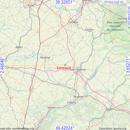
Vermand GPS coordinates[2]
49° 52' 31.8" North, 3° 8' 58.524" East
| Map corner | latitude | longitude |
|---|---|---|
| Upper-left | 50.32651°, | 2.44646° |
| Center: | 49.8755°, | 3.14959° |
| Lower-right: | 49.42024°, | 3.85271° |
| Map W x H: | 100.8×100.8 km | = 62.6×62.6mi |
| max Lat: | 51.07786° ⇑7.2% North |
| Vermand: | 49.8755° |
| min Lat: | ⇓92.8% South 41.3874° |
| min Long | Vermand | max Long |
| -5.08615° | 3.14959° | 9.52242° |
| W 59.9%⇐ | ⇒40.1% E |
Elevation
Elevation of Vermand is 89 m = 292 ft, and this is 104.7 m = 344 ft below average elevation for this country.
| Max E: |
2333 m = 7654 ft | 65.3% |
| Avg. | 193.7 m = 635 ft | |
| Vermand | 89 m = 292 ft | |
Min E: |
-1 m = -3 ft | 34.7% |
See also: France elevation on elevation.city.
Geographical zone
Vermand is located in North temperate zone (between Tropic of Cancer and the Arctic Circle). Distance of this North polar circle is 1855.5 km =1153 mi to North.| Distance of | km | miles | from Vermand |
|---|---|---|---|
| North Pole | 4461.4 | 2772.2 | to North |
| Arctic Circle | 1855.5 | 1153 | to North |
| Tropic Cancer | 2939.7 | 1826.6 | to South |
| Equator | 5545.6 | 3445.9 | to South |


Nearby cities:
15 places around Vermand: (largest is in red/bold)
• Bellicourt
11.4 km =7.1 mi,  32°
32°
• Cartigny
10.6 km =6.6 mi,  292°
292°
• Estrées-Mons
10.1 km =6.3 mi,  271°
271°
• Fayet
7.4 km =4.6 mi,  96°
96°
• Gauchy
10.4 km =6.5 mi,  120°
120°
• Gricourt
6.9 km =4.3 mi,  78°
78°
• Grugies
11 km =6.8 mi,  129°
129°
• Hargicourt
9.8 km =6.1 mi,  12°
12°
• Holnon
5 km =3.1 mi,  109°
109°
• Monchy-Lagache
8 km =5 mi,  250°
250°
• Roisel
8.8 km =5.5 mi,  336°
336°
• Saint-Quentin
10.3 km =6.4 mi, 106°
• Savy
6 km =3.7 mi,  146°
146°
• Seraucourt-le-Grand
11.3 km =7 mi, 154°
• Étreillers
5.1 km =3.2 mi,  171°
171°
Sources, notices
• [Note1] Compared only with cities in France existing in our database
• [Src1] Map data: © OpenStreetMap contributors (CC-BY-SA)
• [Src2] Other city data from geonames.org with taken over terms of usage.
• [Src3] Geographical zone / Annual Mean Temperature by Robert A. Rohde @ Wikipedia
