Roisel geodata
Roisel (Hauts-de-France) is a populated place; located in France in Europe/Paris (GMT+2) time zone. With population of 2,022 people, there are 4740 cities with bigger population in this country. Compared to other cities in France, 93.3% of cities are located further ↓South; 59.3% of cities are located further ←West and 67.4% of cities have higher elevation than Roisel. Note1
Administrative division(s):
- Level 1: Hauts-de-France
- Level 2: Somme
- Level 3: Arrondissement de Péronne
- Level 4: Roisel


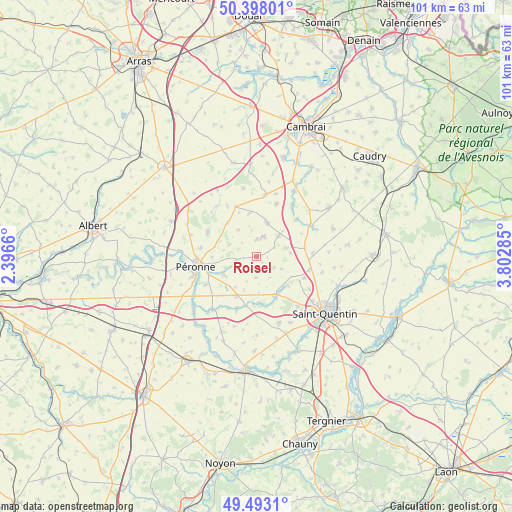
Roisel GPS coordinates[2]
49° 56' 51.648" North, 3° 5' 59.028" East
| Map corner | latitude | longitude |
|---|---|---|
| Upper-left | 50.39801°, | 2.3966° |
| Center: | 49.94768°, | 3.09973° |
| Lower-right: | 49.4931°, | 3.80285° |
| Map W x H: | 100.6×100.6 km | = 62.5×62.5mi |
| max Lat: | 51.07786° ⇑6.7% North |
| Roisel: | 49.94768° |
| min Lat: | ⇓93.3% South 41.3874° |
| min Long | Roisel | max Long |
| -5.08615° | 3.09973° | 9.52242° |
| W 59.3%⇐ | ⇒40.7% E |
Elevation
Elevation of Roisel is 84 m = 276 ft, and this is 109.7 m = 360 ft below average elevation for this country.
| Max E: |
2333 m = 7654 ft | 67.4% |
| Avg. | 193.7 m = 635 ft | |
| Roisel | 84 m = 276 ft | |
Min E: |
-1 m = -3 ft | 32.6% |
See also: France elevation on elevation.city.
Geographical zone
Roisel is located in North temperate zone (between Tropic of Cancer and the Arctic Circle). Distance of this North polar circle is 1847.5 km =1148 mi to North.| Distance of | km | miles | from Roisel |
|---|---|---|---|
| North Pole | 4453.4 | 2767.2 | to North |
| Arctic Circle | 1847.5 | 1148 | to North |
| Tropic Cancer | 2947.7 | 1831.6 | to South |
| Equator | 5553.7 | 3450.9 | to South |


Nearby cities:
15 places around Roisel: (largest is in red/bold)
• Bellicourt
9.8 km =6.1 mi,  80°
80°
• Cartigny
7.4 km =4.6 mi,  237°
237°
• Doingt
9.9 km =6.2 mi,  252°
252°
• Estrées-Mons
10.1 km =6.3 mi,  220°
220°
• Hargicourt
5.9 km =3.7 mi, 75°
• Heudicourt
8.4 km =5.2 mi,  350°
350°
• Moislains
10.7 km =6.6 mi,  294°
294°
• Monchy-Lagache
11.4 km =7.1 mi,  200°
200°
• Nauroy
11.1 km =6.9 mi,  86°
86°
• Péronne
11.8 km =7.3 mi,  261°
261°
• Ronssoy
5.8 km =3.6 mi,  47°
47°
• Vermand
8.8 km =5.5 mi,  156°
156°
• Villers-Faucon
3.3 km =2.1 mi,  2°
2°
• Villers-Guislain
11.1 km =6.9 mi,  20°
20°
• Épehy
6.3 km =3.9 mi, 22°
Sources, notices
• [Note1] Compared only with cities in France existing in our database
• [Src1] Map data: © OpenStreetMap contributors (CC-BY-SA)
• [Src2] Other city data from geonames.org with taken over terms of usage.
• [Src3] Geographical zone / Annual Mean Temperature by Robert A. Rohde @ Wikipedia
