Cartigny geodata
Cartigny (Hauts-de-France) is a populated place; located in France in Europe/Paris (GMT+2) time zone. With population of 644 people, there are 12610 cities with bigger population in this country. Compared to other cities in France, 93.1% of cities are located further ↓South; 58% of cities are located further ←West and 73.6% of cities have higher elevation than Cartigny. Note1
Administrative division(s):
- Level 1: Hauts-de-France
- Level 2: Somme
- Level 3: Arrondissement de Péronne
- Level 4: Cartigny


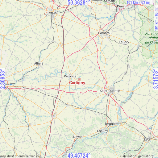
Cartigny GPS coordinates[2]
49° 54' 43.74" North, 3° 0' 45.54" East
| Map corner | latitude | longitude |
|---|---|---|
| Upper-left | 50.36281°, | 2.30953° |
| Center: | 49.91215°, | 3.01265° |
| Lower-right: | 49.45724°, | 3.71578° |
| Map W x H: | 100.7×100.7 km | = 62.6×62.6mi |
| max Lat: | 51.07786° ⇑6.9% North |
| Cartigny: | 49.91215° |
| min Lat: | ⇓93.1% South 41.3874° |
| min Long | Cartigny | max Long |
| -5.08615° | 3.01265° | 9.52242° |
| W 58%⇐ | ⇒42% E |
Elevation
Elevation of Cartigny is 70 m = 230 ft, and this is 123.7 m = 406 ft below average elevation for this country.
| Max E: |
2333 m = 7654 ft | 73.6% |
| Avg. | 193.7 m = 635 ft | |
| Cartigny | 70 m = 230 ft | |
Min E: |
-1 m = -3 ft | 26.4% |
See also: France elevation on elevation.city.
Geographical zone
Cartigny is located in North temperate zone (between Tropic of Cancer and the Arctic Circle). Distance of this North polar circle is 1851.5 km =1150.5 mi to North.| Distance of | km | miles | from Cartigny |
|---|---|---|---|
| North Pole | 4457.4 | 2769.7 | to North |
| Arctic Circle | 1851.5 | 1150.5 | to North |
| Tropic Cancer | 2943.8 | 1829.2 | to South |
| Equator | 5549.7 | 3448.4 | to South |


Nearby cities:
15 places around Cartigny: (largest is in red/bold)
• Athies
6.8 km =4.2 mi,  198°
198°
• Cléry-sur-Somme
10.3 km =6.4 mi,  299°
299°
• Doingt
3.4 km =2.1 mi,  287°
287°
• Estrées-Mons
3.8 km =2.4 mi,  184°
184°
• Hargicourt
13.1 km =8.1 mi,  65°
65°
• Heudicourt
13.1 km =8.1 mi,  21°
21°
• Matigny
12.9 km =8 mi, 181°
• Moislains
9.1 km =5.7 mi,  337°
337°
• Monchy-Lagache
7.1 km =4.4 mi,  161°
161°
• Péronne
5.9 km =3.7 mi, 292°
• Roisel
7.4 km =4.6 mi,  57°
57°
• Ronssoy
13.1 km =8.1 mi,  53°
53°
• Vermand
10.6 km =6.6 mi,  112°
112°
• Villers-Faucon
9.7 km =6 mi,  41°
41°
• Épehy
13 km =8.1 mi, 41°
Sources, notices
• [Note1] Compared only with cities in France existing in our database
• [Src1] Map data: © OpenStreetMap contributors (CC-BY-SA)
• [Src2] Other city data from geonames.org with taken over terms of usage.
• [Src3] Geographical zone / Annual Mean Temperature by Robert A. Rohde @ Wikipedia
