Véranne geodata
Véranne (Auvergne-Rhône-Alpes) is a populated place; located in France in Europe/Paris (GMT+2) time zone. With population of 595 people, there are 13406 cities with bigger population in this country. Compared to other cities in France, 75.6% of cities are located further ↑North; 73.4% of cities are located further ←West and 93.6% of cities have lower elevation than Véranne. Note1
Administrative division(s):
- Level 1: Auvergne-Rhône-Alpes
- Level 2: Département de la Loire
- Level 3: Arrondissement de Saint-Étienne
- Level 4: Véranne


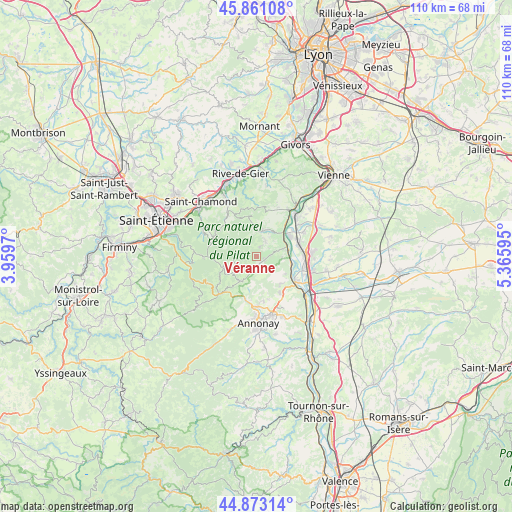
Véranne GPS coordinates[2]
45° 22' 9.372" North, 4° 39' 46.188" East
| Map corner | latitude | longitude |
|---|---|---|
| Upper-left | 45.86108°, | 3.9597° |
| Center: | 45.36927°, | 4.66283° |
| Lower-right: | 44.87314°, | 5.36595° |
| Map W x H: | 109.8×109.8 km | = 68.2×68.2mi |
| max Lat: | 51.07786° ⇑75.6% North |
| Véranne: | 45.36927° |
| min Lat: | ⇓24.4% South 41.3874° |
| min Long | Véranne | max Long |
| -5.08615° | 4.66283° | 9.52242° |
| W 73.4%⇐ | ⇒26.6% E |
Elevation
Elevation of Véranne is 526 m = 1726 ft, and this is 332.3 m = 1090 ft above average elevation for this country.
| Max E: |
2333 m = 7654 ft | 6.4% |
| Véranne | 526 m 1726 ft | |
| Avg. | 193.7 m = 635 ft | |
Min E: |
-1 m = -3 ft | 93.6% |
See also: France elevation on elevation.city.
Geographical zone
Véranne is located in North temperate zone (between Tropic of Cancer and the Arctic Circle). Distance of this North polar circle is 2356.6 km =1464.3 mi to North.| Distance of | km | miles | from Véranne |
|---|---|---|---|
| North Pole | 4962.5 | 3083.6 | to North |
| Arctic Circle | 2356.6 | 1464.3 | to North |
| Tropic Cancer | 2438.7 | 1515.3 | to South |
| Equator | 5044.6 | 3134.6 | to South |


Nearby cities:
15 places around Véranne: (largest is in red/bold)
• Charnas
7.3 km =4.5 mi,  120°
120°
• Chavanay
7.2 km =4.5 mi,  43°
43°
• Doizieux
8.9 km =5.5 mi,  316°
316°
• Félines
7.8 km =4.8 mi,  138°
138°
• Limony
7.7 km =4.8 mi,  104°
104°
• Maclas
1.7 km =1.1 mi, 115°
• Pélussin
5.8 km =3.6 mi,  16°
16°
• Roisey
2.3 km =1.4 mi,  25°
25°
• Saint-Alban-du-Rhône
9.5 km =5.9 mi,  52°
52°
• Saint-Appolinard
3 km =1.9 mi,  189°
189°
• Saint-Julien-Molin-Molette
6.4 km =4 mi,  214°
214°
• Saint-Marcel-lès-Annonay
9.7 km =6 mi,  197°
197°
• Saint-Pierre-de-Bœuf
6.8 km =4.2 mi,  92°
92°
• Savas
8.4 km =5.2 mi,  164°
164°
• Serrières
9.7 km =6 mi,  125°
125°
Sources, notices
• [Note1] Compared only with cities in France existing in our database
• [Src1] Map data: © OpenStreetMap contributors (CC-BY-SA)
• [Src2] Other city data from geonames.org with taken over terms of usage.
• [Src3] Geographical zone / Annual Mean Temperature by Robert A. Rohde @ Wikipedia
