Levie geodata
Levie (Corsica) is a populated place; located in France in Europe/Paris (GMT+2) time zone. With population of 732 people, there are 11386 cities with bigger population in this country. Compared to other cities in France, 100% of cities are located further ↑North; 99.7% of cities are located further ←West and 95.2% of cities have lower elevation than Levie. Note1
Administrative division(s):
- Level 1: Corsica
- Level 2: Département de la Corse-du-Sud
- Level 3: Arrondissement de Sartène
- Level 4: Levie


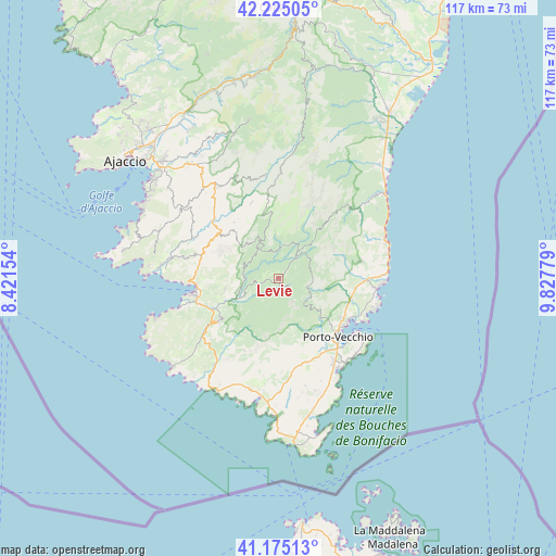
Levie GPS coordinates[2]
41° 42' 8.028" North, 9° 7' 28.776" East
| Map corner | latitude | longitude |
|---|---|---|
| Upper-left | 42.22505°, | 8.42154° |
| Center: | 41.70223°, | 9.12466° |
| Lower-right: | 41.17513°, | 9.82779° |
| Map W x H: | 116.7×116.7 km | = 72.5×72.5mi |
| max Lat: | 51.07786° ⇑100% North |
| Levie: | 41.70223° |
| min Lat: | ⇓0% South 41.3874° |
| min Long | Levie | max Long |
| -5.08615° | 9.12466° | 9.52242° |
| W 99.7%⇐ | ⇒0.3% E |
Elevation
Elevation of Levie is 597 m = 1959 ft, and this is 403.3 m = 1323 ft above average elevation for this country.
| Max E: |
2333 m = 7654 ft | 4.8% |
| Levie | 597 m 1959 ft | |
| Avg. | 193.7 m = 635 ft | |
Min E: |
-1 m = -3 ft | 95.2% |
See also: France elevation on elevation.city.
Geographical zone
Levie is located in North temperate zone (between Tropic of Cancer and the Arctic Circle). Distance of this Northern Tropic circle is 2030.9 km =1261.9 mi to South.| Distance of | km | miles | from Levie |
|---|---|---|---|
| North Pole | 5370.2 | 3336.9 | to North |
| Arctic Circle | 2764.3 | 1717.7 | to North |
| Tropic Cancer | 2030.9 | 1261.9 | to South |
| Equator | 4636.9 | 2881.2 | to South |


Nearby cities:
15 places around Levie: (largest is in red/bold)
• Albitreccia
23.4 km =14.5 mi,  319°
319°
• Conca
17.6 km =10.9 mi,  78°
78°
• Figari
23.8 km =14.8 mi,  178°
178°
• Grosseto-Prugna
23 km =14.3 mi, 324°
• Olmeto
17.2 km =10.7 mi,  275°
275°
• Petreto
15 km =9.3 mi,  307°
307°
• Pianottoli-Caldarello
23.8 km =14.8 mi,  193°
193°
• Pietrosella
27.5 km =17.1 mi,  302°
302°
• Porto-Vecchio
17.8 km =11.1 mi,  133°
133°
• Propriano
18.5 km =11.5 mi,  260°
260°
• San-Gavino-di-Carbini
2.9 km =1.8 mi,  42°
42°
• Sari-Solenzara
25.5 km =15.8 mi,  54°
54°
• Sartène
15.1 km =9.4 mi,  230°
230°
• Sotta
18.5 km =11.5 mi,  161°
161°
• Zonza
6.5 km =4 mi, 36°
Sources, notices
• [Note1] Compared only with cities in France existing in our database
• [Src1] Map data: © OpenStreetMap contributors (CC-BY-SA)
• [Src2] Other city data from geonames.org with taken over terms of usage.
• [Src3] Geographical zone / Annual Mean Temperature by Robert A. Rohde @ Wikipedia
