Vayres geodata
Vayres (Nouvelle-Aquitaine) is a populated place; located in France in Europe/Paris (GMT+2) time zone. With population of 936 people, there are 9332 cities with bigger population in this country. Compared to other cities in France, 69.9% of cities are located further ↑North; 70.5% of cities are located further →East and 80.4% of cities have lower elevation than Vayres. Note1
Administrative division(s):
- Level 1: Nouvelle-Aquitaine
- Level 2: Haute-Vienne
- Level 3: Arrondissement de Rochechouart
- Level 4: Vayres


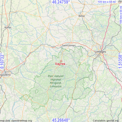
Vayres GPS coordinates[2]
45° 45' 33.084" North, 0° 48' 37.62" East
| Map corner | latitude | longitude |
|---|---|---|
| Upper-left | 46.24759°, | 0.10733° |
| Center: | 45.75919°, | 0.81045° |
| Lower-right: | 45.26648°, | 1.51358° |
| Map W x H: | 109.1×109.1 km | = 67.8×67.8mi |
| max Lat: | 51.07786° ⇑69.9% North |
| Vayres: | 45.75919° |
| min Lat: | ⇓30.1% South 41.3874° |
| min Long | Vayres | max Long |
| -5.08615° | 0.81045° | 9.52242° |
| W 29.5%⇐ | ⇒70.5% E |
Elevation
Elevation of Vayres is 295 m = 968 ft, and this is 101.3 m = 332 ft above average elevation for this country.
| Max E: |
2333 m = 7654 ft | 19.6% |
| Vayres | 295 m 968 ft | |
| Avg. | 193.7 m = 635 ft | |
Min E: |
-1 m = -3 ft | 80.4% |
See also: France elevation on elevation.city.
Geographical zone
Vayres is located in North temperate zone (between Tropic of Cancer and the Arctic Circle). Distance of this North polar circle is 2313.2 km =1437.4 mi to North.| Distance of | km | miles | from Vayres |
|---|---|---|---|
| North Pole | 4919.1 | 3056.6 | to North |
| Arctic Circle | 2313.2 | 1437.4 | to North |
| Tropic Cancer | 2482 | 1542.2 | to South |
| Equator | 5087.9 | 3161.5 | to South |


Nearby cities:
15 places around Vayres: (largest is in red/bold)
• Chabanais
14.6 km =9.1 mi,  330°
330°
• Chaillac-sur-Vienne
14.2 km =8.8 mi,  19°
19°
• Champagnac-la-Rivière
9.6 km =6 mi,  124°
124°
• Champniers-et-Reilhac
11.9 km =7.4 mi,  210°
210°
• Champsac
13 km =8.1 mi, 118°
• Chassenon
10.9 km =6.8 mi,  340°
340°
• Cussac
6.6 km =4.1 mi,  152°
152°
• Marval
14.7 km =9.1 mi,  183°
183°
• Oradour-sur-Vayres
5.3 km =3.3 mi, 124°
• Rochechouart
7.2 km =4.5 mi,  6°
6°
• Saillat-sur-Vienne
12.6 km =7.8 mi,  1°
1°
• Saint-Auvent
10.7 km =6.6 mi,  61°
61°
• Saint-Cyr
12.3 km =7.6 mi,  68°
68°
• Saint-Laurent-sur-Gorre
11.5 km =7.1 mi,  84°
84°
• Saint-Mathieu
7.1 km =4.4 mi, 214°
Sources, notices
• [Note1] Compared only with cities in France existing in our database
• [Src1] Map data: © OpenStreetMap contributors (CC-BY-SA)
• [Src2] Other city data from geonames.org with taken over terms of usage.
• [Src3] Geographical zone / Annual Mean Temperature by Robert A. Rohde @ Wikipedia
