Saint-Mathieu geodata
Saint-Mathieu (Nouvelle-Aquitaine) is a populated place; located in France in Europe/Paris (GMT+2) time zone. With population of 1,181 people, there are 7641 cities with bigger population in this country. Compared to other cities in France, 70.8% of cities are located further ↑North; 70.9% of cities are located further →East and 83.2% of cities have lower elevation than Saint-Mathieu. Note1
Administrative division(s):
- Level 1: Nouvelle-Aquitaine
- Level 2: Haute-Vienne
- Level 3: Arrondissement de Rochechouart
- Level 4: Saint-Mathieu


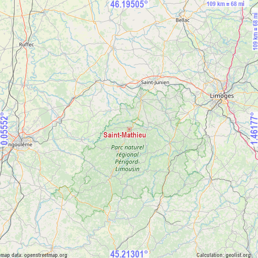
Saint-Mathieu GPS coordinates[2]
45° 42' 22.284" North, 0° 45' 31.14" East
| Map corner | latitude | longitude |
|---|---|---|
| Upper-left | 46.19505°, | 0.05552° |
| Center: | 45.70619°, | 0.75865° |
| Lower-right: | 45.21301°, | 1.46177° |
| Map W x H: | 109.2×109.2 km | = 67.9×67.9mi |
| max Lat: | 51.07786° ⇑70.8% North |
| Saint-Mathieu: | 45.70619° |
| min Lat: | ⇓29.2% South 41.3874° |
| min Long | Saint-Mathieu | max Long |
| -5.08615° | 0.75865° | 9.52242° |
| W 29.1%⇐ | ⇒70.9% E |
Elevation
Elevation of Saint-Mathieu is 324 m = 1063 ft, and this is 130.3 m = 427 ft above average elevation for this country.
| Max E: |
2333 m = 7654 ft | 16.8% |
| Saint-Mathieu | 324 m 1063 ft | |
| Avg. | 193.7 m = 635 ft | |
Min E: |
-1 m = -3 ft | 83.2% |
See also: France elevation on elevation.city.
Geographical zone
Saint-Mathieu is located in North temperate zone (between Tropic of Cancer and the Arctic Circle). Distance of this North polar circle is 2319.1 km =1441 mi to North.| Distance of | km | miles | from Saint-Mathieu |
|---|---|---|---|
| North Pole | 4925 | 3060.3 | to North |
| Arctic Circle | 2319.1 | 1441 | to North |
| Tropic Cancer | 2476.1 | 1538.6 | to South |
| Equator | 5082.1 | 3157.9 | to South |


Nearby cities:
15 places around Saint-Mathieu: (largest is in red/bold)
• Abjat-sur-Bandiat
13.5 km =8.4 mi,  180°
180°
• Augignac
13.7 km =8.5 mi,  199°
199°
• Busserolles
9.6 km =6 mi,  250°
250°
• Bussière-Badil
13.4 km =8.3 mi,  243°
243°
• Champagnac-la-Rivière
12 km =7.5 mi,  87°
87°
• Champniers-et-Reilhac
4.8 km =3 mi, 204°
• Cussac
7.1 km =4.4 mi, 89°
• Dournazac
15.2 km =9.4 mi,  126°
126°
• Marval
9.3 km =5.8 mi,  160°
160°
• Oradour-sur-Vayres
8.9 km =5.5 mi,  71°
71°
• Piégut-Pluviers
10.7 km =6.6 mi,  209°
209°
• Rochechouart
13.9 km =8.6 mi,  20°
20°
• Saint-Estèphe
14.7 km =9.1 mi, 210°
• Vayres
7.1 km =4.4 mi,  34°
34°
• Écuras
15 km =9.3 mi,  260°
260°
Sources, notices
• [Note1] Compared only with cities in France existing in our database
• [Src1] Map data: © OpenStreetMap contributors (CC-BY-SA)
• [Src2] Other city data from geonames.org with taken over terms of usage.
• [Src3] Geographical zone / Annual Mean Temperature by Robert A. Rohde @ Wikipedia
