Marval geodata
Marval (Nouvelle-Aquitaine) is a populated place; located in France in Europe/Paris (GMT+2) time zone. With population of 567 people, there are 13878 cities with bigger population in this country. Compared to other cities in France, 72.1% of cities are located further ↑North; 70.5% of cities are located further →East and 85.7% of cities have lower elevation than Marval. Note1
Administrative division(s):
- Level 1: Nouvelle-Aquitaine
- Level 2: Haute-Vienne
- Level 3: Arrondissement de Rochechouart
- Level 4: Marval


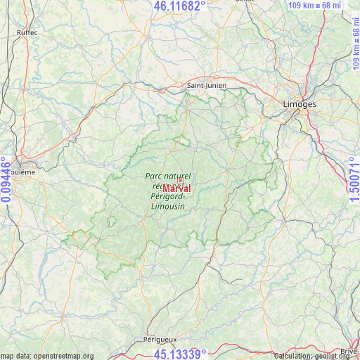
Marval GPS coordinates[2]
45° 37' 38.136" North, 0° 47' 51.288" East
| Map corner | latitude | longitude |
|---|---|---|
| Upper-left | 46.11682°, | 0.09446° |
| Center: | 45.62726°, | 0.79758° |
| Lower-right: | 45.13339°, | 1.50071° |
| Map W x H: | 109.3×109.3 km | = 67.9×67.9mi |
| max Lat: | 51.07786° ⇑72.1% North |
| Marval: | 45.62726° |
| min Lat: | ⇓27.9% South 41.3874° |
| min Long | Marval | max Long |
| -5.08615° | 0.79758° | 9.52242° |
| W 29.5%⇐ | ⇒70.5% E |
Elevation
Elevation of Marval is 356 m = 1168 ft, and this is 162.3 m = 532 ft above average elevation for this country.
| Max E: |
2333 m = 7654 ft | 14.3% |
| Marval | 356 m 1168 ft | |
| Avg. | 193.7 m = 635 ft | |
Min E: |
-1 m = -3 ft | 85.7% |
See also: France elevation on elevation.city.
Geographical zone
Marval is located in North temperate zone (between Tropic of Cancer and the Arctic Circle). Distance of this North polar circle is 2327.9 km =1446.5 mi to North.| Distance of | km | miles | from Marval |
|---|---|---|---|
| North Pole | 4933.8 | 3065.7 | to North |
| Arctic Circle | 2327.9 | 1446.5 | to North |
| Tropic Cancer | 2467.4 | 1533.2 | to South |
| Equator | 5073.3 | 3152.4 | to South |


Nearby cities:
15 places around Marval: (largest is in red/bold)
• Abjat-sur-Bandiat
5.6 km =3.5 mi,  212°
212°
• Augignac
8.7 km =5.4 mi,  241°
241°
• Busserolles
13.3 km =8.3 mi,  294°
294°
• Champagnac-la-Rivière
12.9 km =8 mi,  44°
44°
• Champniers-et-Reilhac
6.6 km =4.1 mi,  311°
311°
• Châlus
14.5 km =9 mi,  77°
77°
• Cussac
9.7 km =6 mi,  24°
24°
• Dournazac
9.2 km =5.7 mi,  91°
91°
• Mialet
12 km =7.5 mi,  136°
136°
• Oradour-sur-Vayres
12.8 km =8 mi, 24°
• Piégut-Pluviers
8.4 km =5.2 mi,  266°
266°
• Saint-Estèphe
11.1 km =6.9 mi,  249°
249°
• Saint-Mathieu
9.3 km =5.8 mi,  340°
340°
• Saint-Saud-Lacoussière
9.4 km =5.8 mi,  169°
169°
• Vayres
14.7 km =9.1 mi,  3°
3°
Sources, notices
• [Note1] Compared only with cities in France existing in our database
• [Src1] Map data: © OpenStreetMap contributors (CC-BY-SA)
• [Src2] Other city data from geonames.org with taken over terms of usage.
• [Src3] Geographical zone / Annual Mean Temperature by Robert A. Rohde @ Wikipedia
