Septmoncel geodata
Septmoncel (Bourgogne-Franche-Comté) is a populated place; located in France in Europe/Paris (GMT+2) time zone. With population of 648 people, there are 12550 cities with bigger population in this country. Compared to other cities in France, 61.4% of cities are located further ↑North; 86.1% of cities are located further ←West and 99% of cities have lower elevation than Septmoncel. Note1
Administrative division(s):
- Level 1: Bourgogne-Franche-Comté
- Level 2: Jura
- Level 3: Arrondissement de Saint-Claude
- Level 4: Septmoncel les Molunes


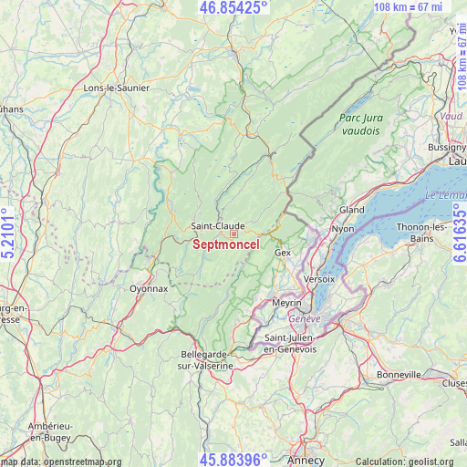
Septmoncel GPS coordinates[2]
46° 22' 16.536" North, 5° 54' 47.592" East
| Map corner | latitude | longitude |
|---|---|---|
| Upper-left | 46.85425°, | 5.2101° |
| Center: | 46.37126°, | 5.91322° |
| Lower-right: | 45.88396°, | 6.61635° |
| Map W x H: | 107.9×107.9 km | = 67×67mi |
| max Lat: | 51.07786° ⇑61.4% North |
| Septmoncel: | 46.37126° |
| min Lat: | ⇓38.6% South 41.3874° |
| min Long | Septmoncel | max Long |
| -5.08615° | 5.91322° | 9.52242° |
| W 86.1%⇐ | ⇒13.9% E |
Elevation
Elevation of Septmoncel is 959 m = 3146 ft, and this is 765.3 m = 2511 ft above average elevation for this country.
| Max E: |
2333 m = 7654 ft | 1% |
| Septmoncel | 959 m 3146 ft | |
| Avg. | 193.7 m = 635 ft | |
Min E: |
-1 m = -3 ft | 99% |
See also: France elevation on elevation.city.
Geographical zone
Septmoncel is located in North temperate zone (between Tropic of Cancer and the Arctic Circle). Distance of this North polar circle is 2245.2 km =1395.1 mi to North.| Distance of | km | miles | from Septmoncel |
|---|---|---|---|
| North Pole | 4851.1 | 3014.3 | to North |
| Arctic Circle | 2245.2 | 1395.1 | to North |
| Tropic Cancer | 2550.1 | 1584.6 | to South |
| Equator | 5156 | 3203.8 | to South |


Nearby cities:
15 places around Septmoncel: (largest is in red/bold)
• Cessy
13.6 km =8.5 mi,  114°
114°
• Chassal
10 km =6.2 mi,  260°
260°
• Chevry
13.9 km =8.6 mi,  136°
136°
• Gex
11.9 km =7.4 mi, 110°
• Lavans-lès-Saint-Claude
10.2 km =6.3 mi,  278°
278°
• Longchaumois
10.2 km =6.3 mi,  7°
7°
• Molinges
11.5 km =7.1 mi, 261°
• Pratz
11.6 km =7.2 mi,  273°
273°
• Prémanon
13 km =8.1 mi,  38°
38°
• Saint-Claude
4.1 km =2.5 mi,  294°
294°
• Saint-Lupicin
9.8 km =6.1 mi, 289°
• Valfin-lès-Saint-Claude
8.6 km =5.3 mi,  328°
328°
• Vaux-lès-Saint-Claude
13.6 km =8.5 mi, 263°
• Villard-Saint-Sauveur
4.1 km =2.5 mi,  252°
252°
• Échenevex
11.9 km =7.4 mi,  125°
125°
Sources, notices
• [Note1] Compared only with cities in France existing in our database
• [Src1] Map data: © OpenStreetMap contributors (CC-BY-SA)
• [Src2] Other city data from geonames.org with taken over terms of usage.
• [Src3] Geographical zone / Annual Mean Temperature by Robert A. Rohde @ Wikipedia
