Buno-Bonnevaux geodata
Buno-Bonnevaux (Île-de-France) is a populated place; located in France in Europe/Paris (GMT+2) time zone. With population of 546 people, there are 14284 cities with bigger population in this country. Compared to other cities in France, 65.6% of cities are located further ↓South; 51.3% of cities are located further →East and 74.1% of cities have higher elevation than Buno-Bonnevaux. Note1
Administrative division(s):
- Level 1: Île-de-France
- Level 2: Département de l'Essonne
- Level 3: Arrondissement d'Évry
- Level 4: Buno-Bonnevaux


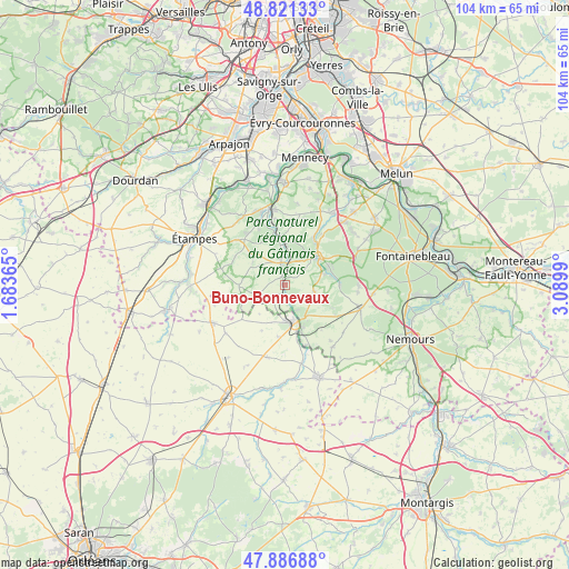
Buno-Bonnevaux GPS coordinates[2]
48° 21' 22.5" North, 2° 23' 12.372" East
| Map corner | latitude | longitude |
|---|---|---|
| Upper-left | 48.82133°, | 1.68365° |
| Center: | 48.35625°, | 2.38677° |
| Lower-right: | 47.88688°, | 3.0899° |
| Map W x H: | 103.9×103.9 km | = 64.6×64.6mi |
| max Lat: | 51.07786° ⇑34.4% North |
| Buno-Bonnevaux: | 48.35625° |
| min Lat: | ⇓65.6% South 41.3874° |
| min Long | Buno-Bonnevaux | max Long |
| -5.08615° | 2.38677° | 9.52242° |
| W 48.7%⇐ | ⇒51.3% E |
Elevation
Elevation of Buno-Bonnevaux is 69 m = 226 ft, and this is 124.7 m = 409 ft below average elevation for this country.
| Max E: |
2333 m = 7654 ft | 74.1% |
| Avg. | 193.7 m = 635 ft | |
| Buno-Bonnevaux | 69 m = 226 ft | |
Min E: |
-1 m = -3 ft | 25.9% |
See also: France elevation on elevation.city.
Geographical zone
Buno-Bonnevaux is located in North temperate zone (between Tropic of Cancer and the Arctic Circle). Distance of this North polar circle is 2024.5 km =1258 mi to North.| Distance of | km | miles | from Buno-Bonnevaux |
|---|---|---|---|
| North Pole | 4630.4 | 2877.2 | to North |
| Arctic Circle | 2024.5 | 1258 | to North |
| Tropic Cancer | 2770.8 | 1721.7 | to South |
| Equator | 5376.7 | 3340.9 | to South |


Nearby cities:
15 places around Buno-Bonnevaux: (largest is in red/bold)
• Boutigny-sur-Essonne
8.6 km =5.3 mi,  358°
358°
• Buthiers
8.4 km =5.2 mi,  156°
156°
• Dannemois
12.9 km =8 mi,  31°
31°
• Gironville-sur-Essonne
1.2 km =0.7 mi,  347°
347°
• Guigneville-sur-Essonne
13.4 km =8.3 mi, 349°
• Le Vaudoué
9.7 km =6 mi,  89°
89°
• Maisse
4.4 km =2.7 mi, 352°
• Malesherbes
6.9 km =4.3 mi,  166°
166°
• Milly-la-Forêt
8.1 km =5 mi,  49°
49°
• Moigny-sur-École
10 km =6.2 mi, 31°
• Noisy-sur-École
9 km =5.6 mi,  82°
82°
• Oncy-sur-École
6.6 km =4.1 mi,  62°
62°
• Valpuiseaux
7.4 km =4.6 mi,  303°
303°
• Vayres-sur-Essonne
9 km =5.6 mi,  342°
342°
• Videlles
12.5 km =7.8 mi,  14°
14°
Sources, notices
• [Note1] Compared only with cities in France existing in our database
• [Src1] Map data: © OpenStreetMap contributors (CC-BY-SA)
• [Src2] Other city data from geonames.org with taken over terms of usage.
• [Src3] Geographical zone / Annual Mean Temperature by Robert A. Rohde @ Wikipedia
