Saint-Nicolas-de-la-Grave geodata
Saint-Nicolas-de-la-Grave (Occitanie) is a populated place; located in France in Europe/Paris (GMT+2) time zone. With population of 2,147 people, there are 4475 cities with bigger population in this country. Compared to other cities in France, 86.6% of cities are located further ↑North; 68.6% of cities are located further →East and 68.7% of cities have higher elevation than Saint-Nicolas-de-la-Grave. Note1
Administrative division(s):
- Level 1: Occitanie
- Level 2: Département du Tarn-et-Garonne
- Level 3: Arrondissement de Castelsarrasin
- Level 4: Saint-Nicolas-de-la-Grave
Current local time in Saint-Nicolas-de-la-Grave:
06:10 AM, WednesdayDifference from your time zone: hours


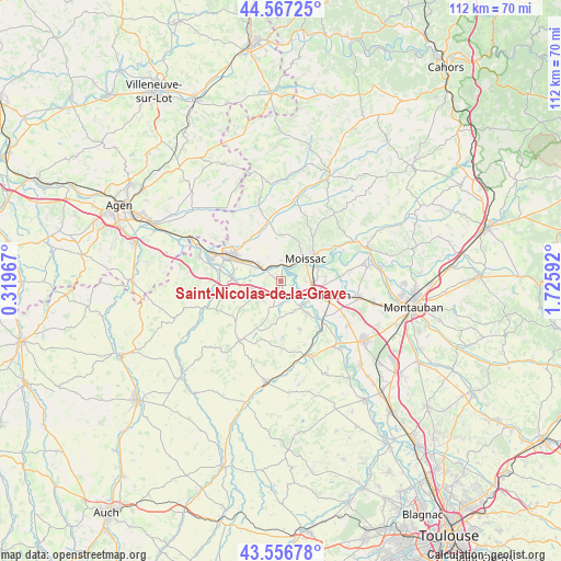
Saint-Nicolas-de-la-Grave GPS coordinates[2]
44° 3' 51.012" North, 1° 1' 22.08" East
| Map corner | latitude | longitude |
|---|---|---|
| Upper-left | 44.56725°, | 0.31967° |
| Center: | 44.06417°, | 1.0228° |
| Lower-right: | 43.55678°, | 1.72592° |
| Map W x H: | 112.4×112.4 km | = 69.8×69.8mi |
| max Lat: | 51.07786° ⇑86.6% North |
| Saint-Nicolas-de-la-Grave: | 44.06417° |
| min Lat: | ⇓13.4% South 41.3874° |
| min Long | Saint-Nicolas-d | max Long |
| -5.08615° | 1.0228° | 9.52242° |
| W 31.4%⇐ | ⇒68.6% E |
Elevation
Elevation of Saint-Nicolas-de-la-Grave is 81 m = 266 ft, and this is 112.7 m = 370 ft below average elevation for this country.
| Max E: |
2333 m = 7654 ft | 68.7% |
| Avg. | 193.7 m = 635 ft | |
| Saint-Nicolas-de-la-Grave | 81 m = 266 ft | |
Min E: |
-1 m = -3 ft | 31.3% |
See also: France elevation on elevation.city.
Geographical zone
Saint-Nicolas-de-la-Grave is located in North temperate zone (between Tropic of Cancer and the Arctic Circle). Distance of this Northern Tropic circle is 2293.6 km =1425.2 mi to South.| Distance of | km | miles | from Saint-Nicolas-de-la-Grave |
|---|---|---|---|
| North Pole | 5107.6 | 3173.7 | to North |
| Arctic Circle | 2501.7 | 1554.5 | to North |
| Tropic Cancer | 2293.6 | 1425.2 | to South |
| Equator | 4899.5 | 3044.4 | to South |


Nearby cities:
15 places around Saint-Nicolas-de-la-Grave: (largest is in red/bold)
• Auvillar
9.7 km =6 mi,  272°
272°
• Boudou
3.6 km =2.2 mi,  347°
347°
• Castelmayran
4.1 km =2.5 mi,  161°
161°
• Castelsagrat
14.6 km =9.1 mi,  335°
335°
• Castelsarrasin
7.2 km =4.5 mi,  111°
111°
• Garganvillar
10.2 km =6.3 mi, 159°
• Golfech
14.7 km =9.1 mi,  292°
292°
• Goudourville
9.4 km =5.8 mi,  306°
306°
• Labastide-du-Temple
14 km =8.7 mi,  80°
80°
• Lavit
14.5 km =9 mi,  214°
214°
• Malause
5 km =3.1 mi, 306°
• Moissac
7.1 km =4.4 mi,  53°
53°
• Montesquieu
14.9 km =9.3 mi,  10°
10°
• Saint-Porquier
14.2 km =8.8 mi,  118°
118°
• Valence
11.6 km =7.2 mi, 294°
Sources, notices
• [Note1] Compared only with cities in France existing in our database
• [Src1] Map data: © OpenStreetMap contributors (CC-BY-SA)
• [Src2] Other city data from geonames.org with taken over terms of usage.
• [Src3] Geographical zone / Annual Mean Temperature by Robert A. Rohde @ Wikipedia
