Boudou geodata
Boudou (Occitanie) is a populated place; located in France in Europe/Paris (GMT+2) time zone. With population of 612 people, there are 13126 cities with bigger population in this country. Compared to other cities in France, 86.3% of cities are located further ↑North; 68.7% of cities are located further →East and 60.7% of cities have lower elevation than Boudou. Note1
Administrative division(s):
- Level 1: Occitanie
- Level 2: Département du Tarn-et-Garonne
- Level 3: Arrondissement de Castelsarrasin
- Level 4: Boudou


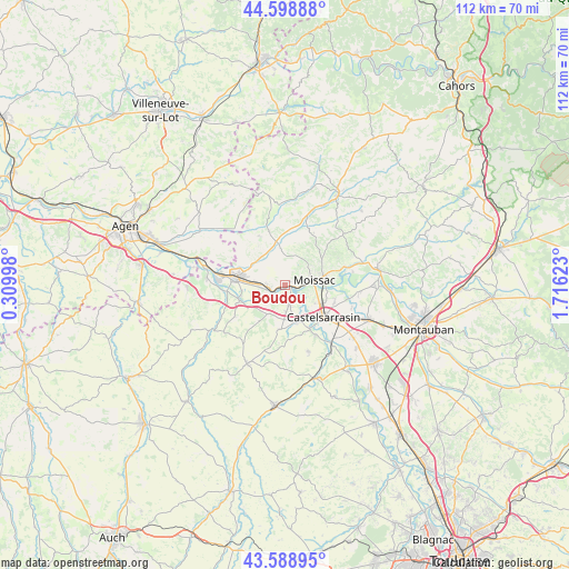
Boudou GPS coordinates[2]
44° 5' 45.852" North, 1° 0' 47.16" East
| Map corner | latitude | longitude |
|---|---|---|
| Upper-left | 44.59888°, | 0.30998° |
| Center: | 44.09607°, | 1.0131° |
| Lower-right: | 43.58895°, | 1.71623° |
| Map W x H: | 112.3×112.3 km | = 69.8×69.8mi |
| max Lat: | 51.07786° ⇑86.3% North |
| Boudou: | 44.09607° |
| min Lat: | ⇓13.7% South 41.3874° |
| min Long | Boudou | max Long |
| -5.08615° | 1.0131° | 9.52242° |
| W 31.3%⇐ | ⇒68.7% E |
Elevation
Elevation of Boudou is 173 m = 568 ft, and this is 20.7 m = 68 ft below average elevation for this country.
| Max E: |
2333 m = 7654 ft | 39.3% |
| Avg. | 193.7 m = 635 ft | |
| Boudou | 173 m = 568 ft | |
Min E: |
-1 m = -3 ft | 60.7% |
See also: France elevation on elevation.city.
Geographical zone
Boudou is located in North temperate zone (between Tropic of Cancer and the Arctic Circle). Distance of this Northern Tropic circle is 2297.1 km =1427.4 mi to South.| Distance of | km | miles | from Boudou |
|---|---|---|---|
| North Pole | 5104 | 3171.5 | to North |
| Arctic Circle | 2498.2 | 1552.3 | to North |
| Tropic Cancer | 2297.1 | 1427.4 | to South |
| Equator | 4903 | 3046.6 | to South |


Nearby cities:
15 places around Boudou: (largest is in red/bold)
• Auvillar
9.4 km =5.8 mi,  251°
251°
• Castelmayran
7.7 km =4.8 mi,  164°
164°
• Castelsagrat
11.1 km =6.9 mi,  331°
331°
• Castelsarrasin
9.7 km =6 mi,  129°
129°
• Durfort-Lacapelette
13.6 km =8.5 mi,  44°
44°
• Garganvillar
13.8 km =8.6 mi, 161°
• Golfech
13 km =8.1 mi,  279°
279°
• Goudourville
7 km =4.3 mi,  286°
286°
• Labastide-du-Temple
14.6 km =9.1 mi,  95°
95°
• Lamagistère
15.4 km =9.6 mi, 282°
• Malause
3.3 km =2.1 mi,  259°
259°
• Moissac
6.5 km =4 mi,  83°
83°
• Montesquieu
11.7 km =7.3 mi,  17°
17°
• Saint-Nicolas-de-la-Grave
3.6 km =2.2 mi,  167°
167°
• Valence
9.8 km =6.1 mi, 277°
Sources, notices
• [Note1] Compared only with cities in France existing in our database
• [Src1] Map data: © OpenStreetMap contributors (CC-BY-SA)
• [Src2] Other city data from geonames.org with taken over terms of usage.
• [Src3] Geographical zone / Annual Mean Temperature by Robert A. Rohde @ Wikipedia
