Bourg-et-Comin geodata
Bourg-et-Comin (Hauts-de-France) is a populated place; located in France in Europe/Paris (GMT+2) time zone. With population of 678 people, there are 12092 cities with bigger population in this country. Compared to other cities in France, 87.8% of cities are located further ↓South; 65.4% of cities are located further ←West and 75% of cities have higher elevation than Bourg-et-Comin. Note1
Administrative division(s):
- Level 1: Hauts-de-France
- Level 2: Département de l'Aisne
- Level 3: Arrondissement de Laon
- Level 4: Bourg-et-Comin


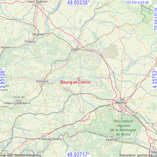
Bourg-et-Comin GPS coordinates[2]
49° 23' 48.876" North, 3° 39' 15.84" East
| Map corner | latitude | longitude |
|---|---|---|
| Upper-left | 49.85238°, | 2.95128° |
| Center: | 49.39691°, | 3.6544° |
| Lower-right: | 48.93717°, | 4.35753° |
| Map W x H: | 101.8×101.8 km | = 63.3×63.3mi |
| max Lat: | 51.07786° ⇑12.2% North |
| Bourg-et-Comin: | 49.39691° |
| min Lat: | ⇓87.8% South 41.3874° |
| min Long | Bourg-et-Comin | max Long |
| -5.08615° | 3.6544° | 9.52242° |
| W 65.4%⇐ | ⇒34.6% E |
Elevation
Elevation of Bourg-et-Comin is 67 m = 220 ft, and this is 126.7 m = 416 ft below average elevation for this country.
| Max E: |
2333 m = 7654 ft | 75% |
| Avg. | 193.7 m = 635 ft | |
| Bourg-et-Comin | 67 m = 220 ft | |
Min E: |
-1 m = -3 ft | 25% |
See also: France elevation on elevation.city.
Geographical zone
Bourg-et-Comin is located in North temperate zone (between Tropic of Cancer and the Arctic Circle). Distance of this North polar circle is 1908.8 km =1186.1 mi to North.| Distance of | km | miles | from Bourg-et-Comin |
|---|---|---|---|
| North Pole | 4514.6 | 2805.2 | to North |
| Arctic Circle | 1908.8 | 1186.1 | to North |
| Tropic Cancer | 2886.5 | 1793.6 | to South |
| Equator | 5492.4 | 3412.8 | to South |


Nearby cities:
15 places around Bourg-et-Comin: (largest is in red/bold)
• Beaurieux
6.2 km =3.9 mi,  93°
93°
• Braine
10.7 km =6.6 mi,  235°
235°
• Bruyères-et-Montbérault
14.3 km =8.9 mi,  2°
2°
• Chassemy
10.8 km =6.7 mi,  260°
260°
• Chavignon
13.2 km =8.2 mi,  313°
313°
• Chivres-Val
15.8 km =9.8 mi,  269°
269°
• Chivy-lès-Étouvelles
15.7 km =9.8 mi,  339°
339°
• Ciry-Salsogne
14.4 km =8.9 mi,  254°
254°
• Corbeny
14.2 km =8.8 mi,  59°
59°
• Festieux
15.8 km =9.8 mi,  27°
27°
• Fismes
10.2 km =6.3 mi,  166°
166°
• Missy-sur-Aisne
15.8 km =9.8 mi, 265°
• Mont-Notre-Dame
12.3 km =7.6 mi,  204°
204°
• Urcel
12.7 km =7.9 mi,  326°
326°
• Vailly-sur-Aisne
10.1 km =6.3 mi,  277°
277°
Sources, notices
• [Note1] Compared only with cities in France existing in our database
• [Src1] Map data: © OpenStreetMap contributors (CC-BY-SA)
• [Src2] Other city data from geonames.org with taken over terms of usage.
• [Src3] Geographical zone / Annual Mean Temperature by Robert A. Rohde @ Wikipedia
