Uzemain geodata
Uzemain (Grand Est) is a populated place; located in France in Europe/Paris (GMT+2) time zone. With population of 1,055 people, there are 8433 cities with bigger population in this country. Compared to other cities in France, 60.9% of cities are located further ↓South; 90.6% of cities are located further ←West and 83.8% of cities have lower elevation than Uzemain. Note1
Administrative division(s):
- Level 1: Grand Est
- Level 2: Vosges
- Level 3: Arrondissement d’Épinal
- Level 4: Uzemain


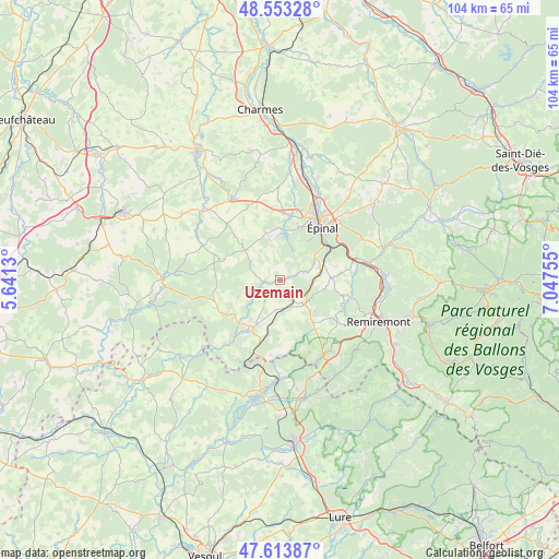
Uzemain GPS coordinates[2]
48° 5' 8.592" North, 6° 20' 39.948" East
| Map corner | latitude | longitude |
|---|---|---|
| Upper-left | 48.55328°, | 5.6413° |
| Center: | 48.08572°, | 6.34443° |
| Lower-right: | 47.61387°, | 7.04755° |
| Map W x H: | 104.5×104.5 km | = 64.9×64.9mi |
| max Lat: | 51.07786° ⇑39.1% North |
| Uzemain: | 48.08572° |
| min Lat: | ⇓60.9% South 41.3874° |
| min Long | Uzemain | max Long |
| -5.08615° | 6.34443° | 9.52242° |
| W 90.6%⇐ | ⇒9.4% E |
Elevation
Elevation of Uzemain is 332 m = 1089 ft, and this is 138.3 m = 454 ft above average elevation for this country.
| Max E: |
2333 m = 7654 ft | 16.2% |
| Uzemain | 332 m 1089 ft | |
| Avg. | 193.7 m = 635 ft | |
Min E: |
-1 m = -3 ft | 83.8% |
See also: France elevation on elevation.city.
Geographical zone
Uzemain is located in North temperate zone (between Tropic of Cancer and the Arctic Circle). Distance of this North polar circle is 2054.5 km =1276.6 mi to North.| Distance of | km | miles | from Uzemain |
|---|---|---|---|
| North Pole | 4660.4 | 2895.8 | to North |
| Arctic Circle | 2054.5 | 1276.6 | to North |
| Tropic Cancer | 2740.7 | 1703 | to South |
| Equator | 5346.6 | 3322.2 | to South |


Nearby cities:
15 places around Uzemain: (largest is in red/bold)
• Bains-les-Bains
11.1 km =6.9 mi,  212°
212°
• Bellefontaine
10.9 km =6.8 mi,  137°
137°
• Chantraine
11.7 km =7.3 mi,  35°
35°
• Chaumousey
9.8 km =6.1 mi,  355°
355°
• Darnieulles
12.7 km =7.9 mi,  1°
1°
• Dounoux
7.7 km =4.8 mi,  74°
74°
• Girancourt
8.9 km =5.5 mi,  343°
343°
• Hadol
9.8 km =6.1 mi,  87°
87°
• Harol
10.2 km =6.3 mi,  316°
316°
• La Chapelle-aux-Bois
5.5 km =3.4 mi,  188°
188°
• Les Forges
10.7 km =6.6 mi,  17°
17°
• Sanchey
10.1 km =6.3 mi,  7°
7°
• Uriménil
4.5 km =2.8 mi, 68°
• Uxegney
12.5 km =7.8 mi, 8°
• Xertigny
6.6 km =4.1 mi,  134°
134°
Sources, notices
• [Note1] Compared only with cities in France existing in our database
• [Src1] Map data: © OpenStreetMap contributors (CC-BY-SA)
• [Src2] Other city data from geonames.org with taken over terms of usage.
• [Src3] Geographical zone / Annual Mean Temperature by Robert A. Rohde @ Wikipedia
