Xertigny geodata
Xertigny (Grand Est) is a populated place; located in France in Europe/Paris (GMT+2) time zone. With population of 2,828 people, there are 3448 cities with bigger population in this country. Compared to other cities in France, 60.1% of cities are located further ↓South; 91.2% of cities are located further ←West and 93.2% of cities have lower elevation than Xertigny. Note1
Administrative division(s):
- Level 1: Grand Est
- Level 2: Vosges
- Level 3: Arrondissement d’Épinal
- Level 4: Xertigny


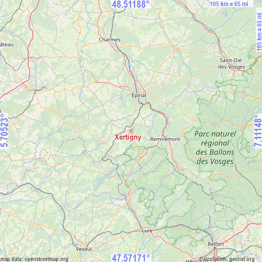
Xertigny GPS coordinates[2]
48° 2' 38.184" North, 6° 24' 30.096" East
| Map corner | latitude | longitude |
|---|---|---|
| Upper-left | 48.51188°, | 5.70523° |
| Center: | 48.04394°, | 6.40836° |
| Lower-right: | 47.57171°, | 7.11148° |
| Map W x H: | 104.5×104.5 km | = 64.9×64.9mi |
| max Lat: | 51.07786° ⇑39.9% North |
| Xertigny: | 48.04394° |
| min Lat: | ⇓60.1% South 41.3874° |
| min Long | Xertigny | max Long |
| -5.08615° | 6.40836° | 9.52242° |
| W 91.2%⇐ | ⇒8.8% E |
Elevation
Elevation of Xertigny is 512 m = 1680 ft, and this is 318.3 m = 1044 ft above average elevation for this country.
| Max E: |
2333 m = 7654 ft | 6.8% |
| Xertigny | 512 m 1680 ft | |
| Avg. | 193.7 m = 635 ft | |
Min E: |
-1 m = -3 ft | 93.2% |
See also: France elevation on elevation.city.
Geographical zone
Xertigny is located in North temperate zone (between Tropic of Cancer and the Arctic Circle). Distance of this North polar circle is 2059.2 km =1279.5 mi to North.| Distance of | km | miles | from Xertigny |
|---|---|---|---|
| North Pole | 4665.1 | 2898.8 | to North |
| Arctic Circle | 2059.2 | 1279.5 | to North |
| Tropic Cancer | 2736.1 | 1700.1 | to South |
| Equator | 5342 | 3319.4 | to South |


Nearby cities:
15 places around Xertigny: (largest is in red/bold)
• Arches
12.2 km =7.6 mi,  46°
46°
• Archettes
13 km =8.1 mi, 47°
• Bains-les-Bains
11.7 km =7.3 mi,  245°
245°
• Bellefontaine
4.3 km =2.7 mi,  142°
142°
• Dounoux
7.3 km =4.5 mi,  21°
21°
• Hadol
7.2 km =4.5 mi,  44°
44°
• La Chapelle-aux-Bois
5.6 km =3.5 mi,  261°
261°
• Le Clerjus
11 km =6.8 mi,  214°
214°
• Plombières-les-Bains
9.7 km =6 mi,  157°
157°
• Pouxeux
14.1 km =8.8 mi,  60°
60°
• Raon-aux-Bois
8.5 km =5.3 mi,  80°
80°
• Remiremont
13.7 km =8.5 mi,  102°
102°
• Saint-Nabord
13 km =8.1 mi,  86°
86°
• Uriménil
6.3 km =3.9 mi,  354°
354°
• Uzemain
6.6 km =4.1 mi,  314°
314°
Sources, notices
• [Note1] Compared only with cities in France existing in our database
• [Src1] Map data: © OpenStreetMap contributors (CC-BY-SA)
• [Src2] Other city data from geonames.org with taken over terms of usage.
• [Src3] Geographical zone / Annual Mean Temperature by Robert A. Rohde @ Wikipedia
