La Chapelle-aux-Bois geodata
La Chapelle-aux-Bois (Grand Est) is a populated place; located in France in Europe/Paris (GMT+2) time zone. With population of 654 people, there are 12467 cities with bigger population in this country. Compared to other cities in France, 59.9% of cities are located further ↓South; 90.6% of cities are located further ←West and 88.6% of cities have lower elevation than La Chapelle-aux-Bois. Note1
Administrative division(s):
- Level 1: Grand Est
- Level 2: Vosges
- Level 3: Arrondissement d’Épinal
- Level 4: La Chapelle-aux-Bois


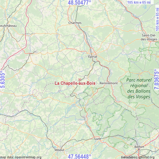
La Chapelle-aux-Bois GPS coordinates[2]
48° 2' 12.372" North, 6° 20' 1.032" East
| Map corner | latitude | longitude |
|---|---|---|
| Upper-left | 48.50477°, | 5.6305° |
| Center: | 48.03677°, | 6.33362° |
| Lower-right: | 47.56448°, | 7.03675° |
| Map W x H: | 104.6×104.5 km | = 65×64.9mi |
| max Lat: | 51.07786° ⇑40.1% North |
| La Chapelle-aux-Bois: | 48.03677° |
| min Lat: | ⇓59.9% South 41.3874° |
| min Long | La Chapelle-aux | max Long |
| -5.08615° | 6.33362° | 9.52242° |
| W 90.6%⇐ | ⇒9.4% E |
Elevation
Elevation of La Chapelle-aux-Bois is 400 m = 1312 ft, and this is 206.3 m = 677 ft above average elevation for this country.
| Max E: |
2333 m = 7654 ft | 11.4% |
| La Chapelle-aux-Bois | 400 m 1312 ft | |
| Avg. | 193.7 m = 635 ft | |
Min E: |
-1 m = -3 ft | 88.6% |
See also: France elevation on elevation.city.
Geographical zone
La Chapelle-aux-Bois is located in North temperate zone (between Tropic of Cancer and the Arctic Circle). Distance of this North polar circle is 2060 km =1280 mi to North.| Distance of | km | miles | from La Chapelle-aux-Bois |
|---|---|---|---|
| North Pole | 4665.9 | 2899.3 | to North |
| Arctic Circle | 2060 | 1280 | to North |
| Tropic Cancer | 2735.3 | 1699.6 | to South |
| Equator | 5341.2 | 3318.9 | to South |


Nearby cities:
15 places around La Chapelle-aux-Bois: (largest is in red/bold)
• Aillevillers-et-Lyaumont
13 km =8.1 mi,  178°
178°
• Bains-les-Bains
6.5 km =4 mi,  232°
232°
• Bellefontaine
8.6 km =5.3 mi,  107°
107°
• Chaumousey
15.2 km =9.4 mi,  0°
0°
• Dounoux
11.2 km =7 mi,  47°
47°
• Fontenoy-le-Château
12.2 km =7.6 mi, 234°
• Girancourt
14.1 km =8.8 mi,  353°
353°
• Hadol
12.2 km =7.6 mi,  60°
60°
• Harol
14.3 km =8.9 mi,  334°
334°
• Le Clerjus
8.3 km =5.2 mi, 184°
• Plombières-les-Bains
12.3 km =7.6 mi,  131°
131°
• Raon-aux-Bois
14.1 km =8.8 mi,  80°
80°
• Uriménil
8.7 km =5.4 mi,  34°
34°
• Uzemain
5.5 km =3.4 mi,  8°
8°
• Xertigny
5.6 km =3.5 mi, 81°
Sources, notices
• [Note1] Compared only with cities in France existing in our database
• [Src1] Map data: © OpenStreetMap contributors (CC-BY-SA)
• [Src2] Other city data from geonames.org with taken over terms of usage.
• [Src3] Geographical zone / Annual Mean Temperature by Robert A. Rohde @ Wikipedia
