Tresses geodata
Tresses (Nouvelle-Aquitaine) is a populated place; located in France in Europe/Paris (GMT+2) time zone. With population of 3,907 people, there are 2517 cities with bigger population in this country. Compared to other cities in France, 81% of cities are located further ↑North; 82.9% of cities are located further →East and 78.2% of cities have higher elevation than Tresses. Note1
Administrative division(s):
- Level 1: Nouvelle-Aquitaine
- Level 2: Gironde
- Level 3: Arrondissement de Bordeaux
- Level 4: Tresses


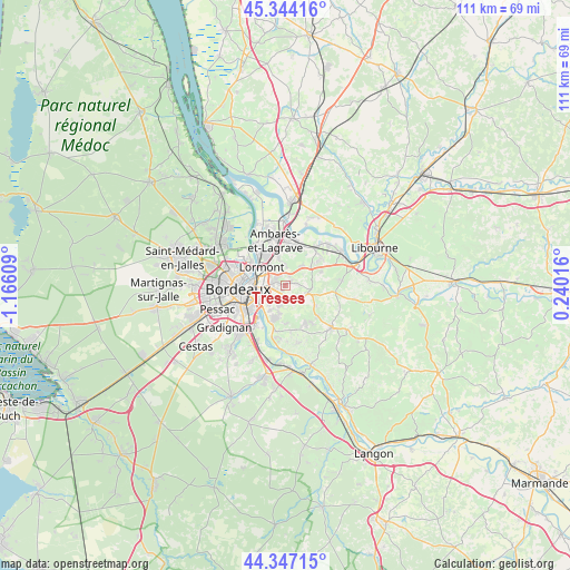
Tresses GPS coordinates[2]
44° 50' 52.116" North, 0° 27' 46.656" West
| Map corner | latitude | longitude |
|---|---|---|
| Upper-left | 45.34416°, | -1.16609° |
| Center: | 44.84781°, | -0.46296° |
| Lower-right: | 44.34715°, | 0.24016° |
| Map W x H: | 110.9×110.9 km | = 68.9×68.9mi |
| max Lat: | 51.07786° ⇑81% North |
| Tresses: | 44.84781° |
| min Lat: | ⇓19% South 41.3874° |
| min Long | Tresses | max Long |
| -5.08615° | -0.46296° | 9.52242° |
| W 17.1%⇐ | ⇒82.9% E |
Elevation
Elevation of Tresses is 59 m = 194 ft, and this is 134.7 m = 442 ft below average elevation for this country.
| Max E: |
2333 m = 7654 ft | 78.2% |
| Avg. | 193.7 m = 635 ft | |
| Tresses | 59 m = 194 ft | |
Min E: |
-1 m = -3 ft | 21.8% |
See also: France elevation on elevation.city.
Geographical zone
Tresses is located in North temperate zone (between Tropic of Cancer and the Arctic Circle). Distance of this Northern Tropic circle is 2380.7 km =1479.3 mi to South.| Distance of | km | miles | from Tresses |
|---|---|---|---|
| North Pole | 5020.5 | 3119.6 | to North |
| Arctic Circle | 2414.6 | 1500.4 | to North |
| Tropic Cancer | 2380.7 | 1479.3 | to South |
| Equator | 4986.6 | 3098.5 | to South |


Nearby cities:
15 places around Tresses: (largest is in red/bold)
• Artigues-près-Bordeaux
4.2 km =2.6 mi,  273°
273°
• Beychac-et-Caillau
5.8 km =3.6 mi,  55°
55°
• Bonnetan
5.2 km =3.2 mi,  133°
133°
• Bouliac
4.6 km =2.9 mi,  222°
222°
• Carbon-Blanc
6.2 km =3.9 mi,  330°
330°
• Carignan-de-Bordeaux
5.6 km =3.5 mi,  196°
196°
• Cenon
4.5 km =2.8 mi,  281°
281°
• Fargues-Saint-Hilaire
3 km =1.9 mi,  155°
155°
• Floirac
4.4 km =2.7 mi,  246°
246°
• Lignan-de-Bordeaux
6.3 km =3.9 mi,  153°
153°
• Lormont
5.3 km =3.3 mi,  304°
304°
• Montussan
4.9 km =3 mi,  41°
41°
• Pompignac
2.1 km =1.3 mi,  79°
79°
• Sallebœuf
5.2 km =3.2 mi,  107°
107°
• Yvrac
3.4 km =2.1 mi,  5°
5°
Sources, notices
• [Note1] Compared only with cities in France existing in our database
• [Src1] Map data: © OpenStreetMap contributors (CC-BY-SA)
• [Src2] Other city data from geonames.org with taken over terms of usage.
• [Src3] Geographical zone / Annual Mean Temperature by Robert A. Rohde @ Wikipedia
