Treize-Septiers geodata
Treize-Septiers (Pays de la Loire) is a populated place; located in France in Europe/Paris (GMT+2) time zone. With population of 2,561 people, there are 3802 cities with bigger population in this country. Compared to other cities in France, 55.4% of cities are located further ↑North; 90.2% of cities are located further →East and 75.4% of cities have higher elevation than Treize-Septiers. Note1
Administrative division(s):
- Level 1: Pays de la Loire
- Level 2: Département de la Vendée
- Level 3: Arrondissement de La Roche-sur-Yon
- Level 4: Treize-Septiers


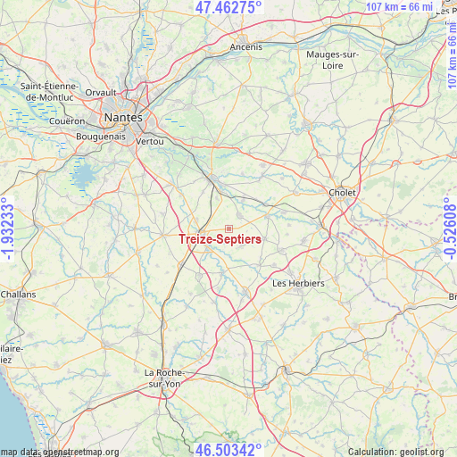
Treize-Septiers GPS coordinates[2]
46° 59' 6.864" North, 1° 13' 45.156" West
| Map corner | latitude | longitude |
|---|---|---|
| Upper-left | 47.46275°, | -1.93233° |
| Center: | 46.98524°, | -1.22921° |
| Lower-right: | 46.50342°, | -0.52608° |
| Map W x H: | 106.7×106.7 km | = 66.3×66.3mi |
| max Lat: | 51.07786° ⇑55.4% North |
| Treize-Septiers: | 46.98524° |
| min Lat: | ⇓44.6% South 41.3874° |
| min Long | Treize-Septiers | max Long |
| -5.08615° | -1.22921° | 9.52242° |
| W 9.8%⇐ | ⇒90.2% E |
Elevation
Elevation of Treize-Septiers is 66 m = 217 ft, and this is 127.7 m = 419 ft below average elevation for this country.
| Max E: |
2333 m = 7654 ft | 75.4% |
| Avg. | 193.7 m = 635 ft | |
| Treize-Septiers | 66 m = 217 ft | |
Min E: |
-1 m = -3 ft | 24.6% |
See also: France elevation on elevation.city.
Geographical zone
Treize-Septiers is located in North temperate zone (between Tropic of Cancer and the Arctic Circle). Distance of this North polar circle is 2176.9 km =1352.7 mi to North.| Distance of | km | miles | from Treize-Septiers |
|---|---|---|---|
| North Pole | 4782.8 | 2971.9 | to North |
| Arctic Circle | 2176.9 | 1352.7 | to North |
| Tropic Cancer | 2618.3 | 1626.9 | to South |
| Equator | 5224.3 | 3246.2 | to South |


Nearby cities:
15 places around Treize-Septiers: (largest is in red/bold)
• Boufféré
8.8 km =5.5 mi,  252°
252°
• Boussay
7.4 km =4.6 mi,  26°
26°
• Cugand
8.8 km =5.5 mi,  348°
348°
• Gétigné
10.2 km =6.3 mi, 351°
• La Bernardière
7.7 km =4.8 mi,  338°
338°
• La Boissière-de-Montaigu
4.9 km =3 mi,  143°
143°
• La Bruffière
4.1 km =2.5 mi,  36°
36°
• La Guyonnière
2.8 km =1.7 mi,  215°
215°
• Les Landes-Genusson
8.8 km =5.5 mi,  103°
103°
• Montaigu
6.1 km =3.8 mi,  260°
260°
• Saint-Georges-de-Montaigu
6.5 km =4 mi,  228°
228°
• Saint-Hilaire-de-Clisson
10.4 km =6.5 mi,  325°
325°
• Saint-Hilaire-de-Loulay
7.9 km =4.9 mi,  283°
283°
• Tiffauges
9.5 km =5.9 mi,  72°
72°
• Torfou
10.3 km =6.4 mi,  56°
56°
Sources, notices
• [Note1] Compared only with cities in France existing in our database
• [Src1] Map data: © OpenStreetMap contributors (CC-BY-SA)
• [Src2] Other city data from geonames.org with taken over terms of usage.
• [Src3] Geographical zone / Annual Mean Temperature by Robert A. Rohde @ Wikipedia
