Torigni-sur-Vire geodata
Torigni-sur-Vire (Normandy) is a populated place; located in France in Europe/Paris (GMT+2) time zone. With population of 2,648 people, there are 3677 cities with bigger population in this country. Compared to other cities in France, 80.5% of cities are located further ↓South; 88% of cities are located further →East and 71.9% of cities have higher elevation than Torigni-sur-Vire. Note1
Administrative division(s):
- Level 1: Normandy
- Level 2: Manche
- Level 3: Arrondissement de Saint-Lô
- Level 4: Torigny-les-Villes


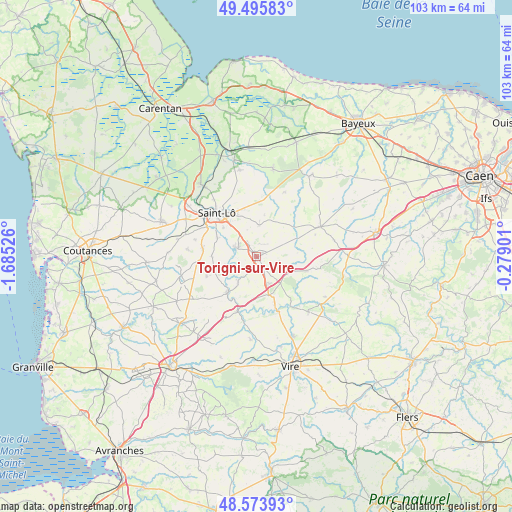
Torigni-sur-Vire GPS coordinates[2]
49° 2' 13.272" North, 0° 58' 55.704" West
| Map corner | latitude | longitude |
|---|---|---|
| Upper-left | 49.49583°, | -1.68526° |
| Center: | 49.03702°, | -0.98214° |
| Lower-right: | 48.57393°, | -0.27901° |
| Map W x H: | 102.5×102.5 km | = 63.7×63.7mi |
| max Lat: | 51.07786° ⇑19.5% North |
| Torigni-sur-Vire: | 49.03702° |
| min Lat: | ⇓80.5% South 41.3874° |
| min Long | Torigni-sur-Vir | max Long |
| -5.08615° | -0.98214° | 9.52242° |
| W 12%⇐ | ⇒88% E |
Elevation
Elevation of Torigni-sur-Vire is 74 m = 243 ft, and this is 119.7 m = 393 ft below average elevation for this country.
| Max E: |
2333 m = 7654 ft | 71.9% |
| Avg. | 193.7 m = 635 ft | |
| Torigni-sur-Vire | 74 m = 243 ft | |
Min E: |
-1 m = -3 ft | 28.1% |
See also: France elevation on elevation.city.
Geographical zone
Torigni-sur-Vire is located in North temperate zone (between Tropic of Cancer and the Arctic Circle). Distance of this North polar circle is 1948.8 km =1210.9 mi to North.| Distance of | km | miles | from Torigni-sur-Vire |
|---|---|---|---|
| North Pole | 4554.7 | 2830.2 | to North |
| Arctic Circle | 1948.8 | 1210.9 | to North |
| Tropic Cancer | 2846.5 | 1768.7 | to South |
| Equator | 5452.4 | 3388 | to South |


Nearby cities:
15 places around Torigni-sur-Vire: (largest is in red/bold)
• Campeaux
10.3 km =6.4 mi,  158°
158°
• Condé-sur-Vire
4 km =2.5 mi,  291°
291°
• Domjean
6.6 km =4.1 mi,  213°
213°
• Giéville
2.5 km =1.6 mi,  172°
172°
• Guilberville
6.1 km =3.8 mi,  152°
152°
• La Barre-de-Semilly
9.2 km =5.7 mi,  335°
335°
• La Mancellière-sur-Vire
7.4 km =4.6 mi,  298°
298°
• Moyon
10.8 km =6.7 mi,  247°
247°
• Saint-Amand
1.4 km =0.9 mi,  60°
60°
• Saint-Jean-des-Baisants
6.3 km =3.9 mi,  6°
6°
• Saint-Martin-des-Besaces
10.4 km =6.5 mi,  106°
106°
• Saint-Romphaire
9 km =5.6 mi,  270°
270°
• Saint-Samson-de-Bonfossé
10.8 km =6.7 mi,  277°
277°
• Sainte-Suzanne-sur-Vire
6.3 km =3.9 mi, 296°
• Tessy-sur-Vire
9.1 km =5.7 mi,  219°
219°
Sources, notices
• [Note1] Compared only with cities in France existing in our database
• [Src1] Map data: © OpenStreetMap contributors (CC-BY-SA)
• [Src2] Other city data from geonames.org with taken over terms of usage.
• [Src3] Geographical zone / Annual Mean Temperature by Robert A. Rohde @ Wikipedia
