Saint-Jean-des-Baisants geodata
Saint-Jean-des-Baisants (Normandy) is a populated place; located in France in Europe/Paris (GMT+2) time zone. With population of 1,019 people, there are 8696 cities with bigger population in this country. Compared to other cities in France, 82% of cities are located further ↓South; 87.9% of cities are located further →East and 67.6% of cities have lower elevation than Saint-Jean-des-Baisants. Note1
Administrative division(s):
- Level 1: Normandy
- Level 2: Manche
- Level 3: Arrondissement de Saint-Lô
- Level 4: Saint-Jean-d'Elle
Current local time in Saint-Jean-des-Baisants:
04:51 PM, SaturdayDifference from your time zone: hours


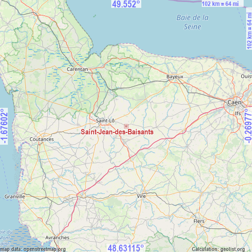
Saint-Jean-des-Baisants GPS coordinates[2]
49° 5' 37.356" North, 0° 58' 22.404" West
| Map corner | latitude | longitude |
|---|---|---|
| Upper-left | 49.552°, | -1.67602° |
| Center: | 49.09371°, | -0.97289° |
| Lower-right: | 48.63115°, | -0.26977° |
| Map W x H: | 102.4×102.4 km | = 63.6×63.6mi |
| max Lat: | 51.07786° ⇑18% North |
| Saint-Jean-des-Baisants: | 49.09371° |
| min Lat: | ⇓82% South 41.3874° |
| min Long | Saint-Jean-des- | max Long |
| -5.08615° | -0.97289° | 9.52242° |
| W 12.1%⇐ | ⇒87.9% E |
Elevation
Elevation of Saint-Jean-des-Baisants is 207 m = 679 ft, and this is 13.3 m = 44 ft above average elevation for this country.
| Max E: |
2333 m = 7654 ft | 32.4% |
| Saint-Jean-des-Baisants | 207 m 679 ft | |
| Avg. | 193.7 m = 635 ft | |
Min E: |
-1 m = -3 ft | 67.6% |
See also: France elevation on elevation.city.
Geographical zone
Saint-Jean-des-Baisants is located in North temperate zone (between Tropic of Cancer and the Arctic Circle). Distance of this North polar circle is 1942.5 km =1207 mi to North.| Distance of | km | miles | from Saint-Jean-des-Baisants |
|---|---|---|---|
| North Pole | 4548.4 | 2826.2 | to North |
| Arctic Circle | 1942.5 | 1207 | to North |
| Tropic Cancer | 2852.8 | 1772.6 | to South |
| Equator | 5458.7 | 3391.9 | to South |


Nearby cities:
15 places around Saint-Jean-des-Baisants: (largest is in red/bold)
• Agneaux
10.1 km =6.3 mi,  286°
286°
• Caumont-l'Éventé
12.2 km =7.6 mi,  91°
91°
• Cerisy-la-Forêt
11.5 km =7.1 mi,  13°
13°
• Condé-sur-Vire
6.6 km =4.1 mi,  222°
222°
• Giéville
8.8 km =5.5 mi,  182°
182°
• Guilberville
11.9 km =7.4 mi,  169°
169°
• La Barre-de-Semilly
4.9 km =3 mi, 294°
• La Mancellière-sur-Vire
7.6 km =4.7 mi,  248°
248°
• Saint-Amand
5.6 km =3.5 mi, 174°
• Saint-Clair-sur-l'Elle
11.7 km =7.3 mi,  339°
339°
• Saint-Georges-Montcocq
9.6 km =6 mi, 293°
• Saint-Lô
8.9 km =5.5 mi, 286°
• Saint-Romphaire
11.5 km =7.1 mi,  237°
237°
• Sainte-Suzanne-sur-Vire
7.2 km =4.5 mi, 240°
• Torigni-sur-Vire
6.3 km =3.9 mi,  186°
186°
Sources, notices
• [Note1] Compared only with cities in France existing in our database
• [Src1] Map data: © OpenStreetMap contributors (CC-BY-SA)
• [Src2] Other city data from geonames.org with taken over terms of usage.
• [Src3] Geographical zone / Annual Mean Temperature by Robert A. Rohde @ Wikipedia
