Thorigné-sur-Dué geodata
Thorigné-sur-Dué (Pays de la Loire) is a populated place; located in France in Europe/Paris (GMT+2) time zone. With population of 1,561 people, there are 5964 cities with bigger population in this country. Compared to other cities in France, 60% of cities are located further ↓South; 73.1% of cities are located further →East and 66% of cities have higher elevation than Thorigné-sur-Dué. Note1
Administrative division(s):
- Level 1: Pays de la Loire
- Level 2: Sarthe
- Level 3: Arrondissement de Mamers
- Level 4: Thorigné-sur-Dué


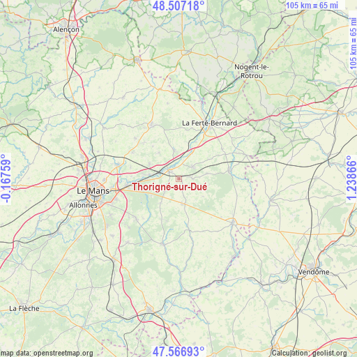
Thorigné-sur-Dué GPS coordinates[2]
48° 2' 21.12" North, 0° 32' 7.944" East
| Map corner | latitude | longitude |
|---|---|---|
| Upper-left | 48.50718°, | -0.16759° |
| Center: | 48.0392°, | 0.53554° |
| Lower-right: | 47.56693°, | 1.23866° |
| Map W x H: | 104.5×104.5 km | = 64.9×64.9mi |
| max Lat: | 51.07786° ⇑40% North |
| Thorigné-sur-Dué: | 48.0392° |
| min Lat: | ⇓60% South 41.3874° |
| min Long | Thorigné-sur-D | max Long |
| -5.08615° | 0.53554° | 9.52242° |
| W 26.9%⇐ | ⇒73.1% E |
Elevation
Elevation of Thorigné-sur-Dué is 87 m = 285 ft, and this is 106.7 m = 350 ft below average elevation for this country.
| Max E: |
2333 m = 7654 ft | 66% |
| Avg. | 193.7 m = 635 ft | |
| Thorigné-sur-Dué | 87 m = 285 ft | |
Min E: |
-1 m = -3 ft | 34% |
See also: France elevation on elevation.city.
Geographical zone
Thorigné-sur-Dué is located in North temperate zone (between Tropic of Cancer and the Arctic Circle). Distance of this North polar circle is 2059.7 km =1279.8 mi to North.| Distance of | km | miles | from Thorigné-sur-Dué |
|---|---|---|---|
| North Pole | 4665.6 | 2899.1 | to North |
| Arctic Circle | 2059.7 | 1279.8 | to North |
| Tropic Cancer | 2735.5 | 1699.8 | to South |
| Equator | 5341.5 | 3319.1 | to South |


Nearby cities:
15 places around Thorigné-sur-Dué: (largest is in red/bold)
• Bouloire
7.3 km =4.5 mi,  171°
171°
• Connerré
3.7 km =2.3 mi,  302°
302°
• Coudrecieux
8.6 km =5.3 mi,  126°
126°
• Dollon
3.8 km =2.4 mi,  90°
90°
• Duneau
3.4 km =2.1 mi,  340°
340°
• La Chapelle-Saint-Rémy
9.6 km =6 mi,  322°
322°
• Lavaré
8.3 km =5.2 mi,  78°
78°
• Le Breil-sur-Mérize
5.5 km =3.4 mi,  230°
230°
• Le Luart
5.1 km =3.2 mi,  46°
46°
• Lombron
9.7 km =6 mi, 296°
• Montfort-le-Gesnois
8.9 km =5.5 mi,  277°
277°
• Saint-Michel-de-Chavaignes
3.6 km =2.2 mi, 130°
• Sceaux-sur-Huisne
8.2 km =5.1 mi,  26°
26°
• Soulitré
6.7 km =4.2 mi,  242°
242°
• Tuffé
8.4 km =5.2 mi,  349°
349°
Sources, notices
• [Note1] Compared only with cities in France existing in our database
• [Src1] Map data: © OpenStreetMap contributors (CC-BY-SA)
• [Src2] Other city data from geonames.org with taken over terms of usage.
• [Src3] Geographical zone / Annual Mean Temperature by Robert A. Rohde @ Wikipedia
