Thoissey geodata
Thoissey (Auvergne-Rhône-Alpes) is a populated place; located in France in Europe/Paris (GMT+2) time zone. With population of 1,493 people, there are 6213 cities with bigger population in this country. Compared to other cities in France, 64% of cities are located further ↑North; 75.1% of cities are located further ←West and 61% of cities have lower elevation than Thoissey. Note1
Administrative division(s):
- Level 1: Auvergne-Rhône-Alpes
- Level 2: Département de l'Ain
- Level 3: Arrondissement de Bourg-en-Bresse
- Level 4: Thoissey


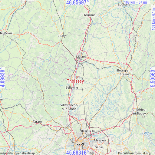
Thoissey GPS coordinates[2]
46° 10' 19.992" North, 4° 48' 9.036" East
| Map corner | latitude | longitude |
|---|---|---|
| Upper-left | 46.65697°, | 4.09938° |
| Center: | 46.17222°, | 4.80251° |
| Lower-right: | 45.68316°, | 5.50563° |
| Map W x H: | 108.3×108.3 km | = 67.3×67.3mi |
| max Lat: | 51.07786° ⇑64% North |
| Thoissey: | 46.17222° |
| min Lat: | ⇓36% South 41.3874° |
| min Long | Thoissey | max Long |
| -5.08615° | 4.80251° | 9.52242° |
| W 75.1%⇐ | ⇒24.9% E |
Elevation
Elevation of Thoissey is 175 m = 574 ft, and this is 18.7 m = 61 ft below average elevation for this country.
| Max E: |
2333 m = 7654 ft | 39% |
| Avg. | 193.7 m = 635 ft | |
| Thoissey | 175 m = 574 ft | |
Min E: |
-1 m = -3 ft | 61% |
See also: France elevation on elevation.city.
Geographical zone
Thoissey is located in North temperate zone (between Tropic of Cancer and the Arctic Circle). Distance of this North polar circle is 2267.3 km =1408.8 mi to North.| Distance of | km | miles | from Thoissey |
|---|---|---|---|
| North Pole | 4873.2 | 3028.1 | to North |
| Arctic Circle | 2267.3 | 1408.8 | to North |
| Tropic Cancer | 2528 | 1570.8 | to South |
| Equator | 5133.9 | 3190.1 | to South |


Nearby cities:
15 places around Thoissey: (largest is in red/bold)
• Belleville
8.2 km =5.1 mi,  210°
210°
• Corcelles-en-Beaujolais
6.4 km =4 mi,  251°
251°
• Cormoranche-sur-Saône
7.7 km =4.8 mi,  19°
19°
• Crêches-sur-Saône
8.2 km =5.1 mi,  351°
351°
• Dracé
3.3 km =2.1 mi,  238°
238°
• Garnerans
5 km =3.1 mi,  37°
37°
• Guéreins
8 km =5 mi,  196°
196°
• Illiat
6.6 km =4.1 mi,  73°
73°
• La Chapelle-de-Guinchay
5.1 km =3.2 mi,  322°
322°
• Lancié
6.8 km =4.2 mi,  268°
268°
• Mogneneins
3.8 km =2.4 mi,  170°
170°
• Romanèche-Thorins
4.8 km =3 mi,  285°
285°
• Saint-Didier-sur-Chalaronne
1.2 km =0.7 mi,  62°
62°
• Saint-Étienne-sur-Chalaronne
6 km =3.7 mi,  117°
117°
• Taponas
6.3 km =3.9 mi, 205°
Sources, notices
• [Note1] Compared only with cities in France existing in our database
• [Src1] Map data: © OpenStreetMap contributors (CC-BY-SA)
• [Src2] Other city data from geonames.org with taken over terms of usage.
• [Src3] Geographical zone / Annual Mean Temperature by Robert A. Rohde @ Wikipedia
