Garnerans geodata
Garnerans (Auvergne-Rhône-Alpes) is a populated place; located in France in Europe/Paris (GMT+2) time zone. With population of 623 people, there are 12932 cities with bigger population in this country. Compared to other cities in France, 63.4% of cities are located further ↑North; 75.7% of cities are located further ←West and 65.6% of cities have lower elevation than Garnerans. Note1
Administrative division(s):
- Level 1: Auvergne-Rhône-Alpes
- Level 2: Département de l'Ain
- Level 3: Arrondissement de Bourg-en-Bresse
- Level 4: Garnerans


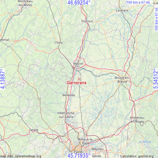
Garnerans GPS coordinates[2]
46° 12' 29.16" North, 4° 50' 31.164" East
| Map corner | latitude | longitude |
|---|---|---|
| Upper-left | 46.69254°, | 4.13887° |
| Center: | 46.2081°, | 4.84199° |
| Lower-right: | 45.71935°, | 5.54512° |
| Map W x H: | 108.2×108.2 km | = 67.2×67.2mi |
| max Lat: | 51.07786° ⇑63.4% North |
| Garnerans: | 46.2081° |
| min Lat: | ⇓36.6% South 41.3874° |
| min Long | Garnerans | max Long |
| -5.08615° | 4.84199° | 9.52242° |
| W 75.7%⇐ | ⇒24.3% E |
Elevation
Elevation of Garnerans is 197 m = 646 ft, and this is 3.3 m = 11 ft above average elevation for this country.
| Max E: |
2333 m = 7654 ft | 34.4% |
| Garnerans | 197 m 646 ft | |
| Avg. | 193.7 m = 635 ft | |
Min E: |
-1 m = -3 ft | 65.6% |
See also: France elevation on elevation.city.
Geographical zone
Garnerans is located in North temperate zone (between Tropic of Cancer and the Arctic Circle). Distance of this North polar circle is 2263.3 km =1406.3 mi to North.| Distance of | km | miles | from Garnerans |
|---|---|---|---|
| North Pole | 4869.2 | 3025.6 | to North |
| Arctic Circle | 2263.3 | 1406.3 | to North |
| Tropic Cancer | 2531.9 | 1573.2 | to South |
| Equator | 5137.9 | 3192.5 | to South |


Nearby cities:
15 places around Garnerans: (largest is in red/bold)
• Biziat
7.8 km =4.8 mi,  82°
82°
• Cormoranche-sur-Saône
3.3 km =2.1 mi,  351°
351°
• Cruzilles-lès-Mépillat
3.4 km =2.1 mi,  56°
56°
• Crêches-sur-Saône
5.9 km =3.7 mi,  313°
313°
• Grièges
5.4 km =3.4 mi,  5°
5°
• Illiat
3.9 km =2.4 mi,  123°
123°
• La Chapelle-de-Guinchay
6.1 km =3.8 mi,  270°
270°
• Laiz
6 km =3.7 mi,  37°
37°
• Mogneneins
8.1 km =5 mi,  197°
197°
• Pont-de-Veyle
6.9 km =4.3 mi,  29°
29°
• Romanèche-Thorins
8.1 km =5 mi,  250°
250°
• Saint-Didier-sur-Chalaronne
4 km =2.5 mi,  209°
209°
• Saint-Jean-sur-Veyle
8.1 km =5 mi,  45°
45°
• Saint-Étienne-sur-Chalaronne
7.1 km =4.4 mi,  161°
161°
• Thoissey
5 km =3.1 mi,  217°
217°
Sources, notices
• [Note1] Compared only with cities in France existing in our database
• [Src1] Map data: © OpenStreetMap contributors (CC-BY-SA)
• [Src2] Other city data from geonames.org with taken over terms of usage.
• [Src3] Geographical zone / Annual Mean Temperature by Robert A. Rohde @ Wikipedia
