Hatten geodata
Hatten (Grand Est) is a populated place; located in France in Europe/Paris (GMT+2) time zone. With population of 1,965 people, there are 4868 cities with bigger population in this country. Compared to other cities in France, 77.6% of cities are located further ↓South; 99.4% of cities are located further ←West and 55.3% of cities have lower elevation than Hatten. Note1
Administrative division(s):
- Level 1: Grand Est
- Level 2: Bas-Rhin
- Level 3: Arrondissement de Haguenau-Wissembourg
- Level 4: Hatten


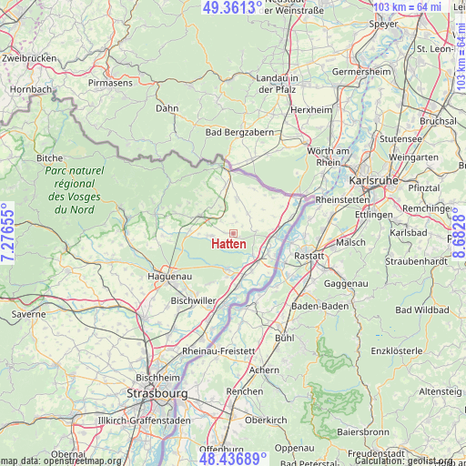
Hatten GPS coordinates[2]
48° 54' 4.428" North, 7° 58' 46.848" East
| Map corner | latitude | longitude |
|---|---|---|
| Upper-left | 49.3613°, | 7.27655° |
| Center: | 48.90123°, | 7.97968° |
| Lower-right: | 48.43689°, | 8.6828° |
| Map W x H: | 102.8×102.8 km | = 63.9×63.9mi |
| max Lat: | 51.07786° ⇑22.4% North |
| Hatten: | 48.90123° |
| min Lat: | ⇓77.6% South 41.3874° |
| min Long | Hatten | max Long |
| -5.08615° | 7.97968° | 9.52242° |
| W 99.4%⇐ | ⇒0.59999999999999% E |
Elevation
Elevation of Hatten is 151 m = 495 ft, and this is 42.7 m = 140 ft below average elevation for this country.
| Max E: |
2333 m = 7654 ft | 44.7% |
| Avg. | 193.7 m = 635 ft | |
| Hatten | 151 m = 495 ft | |
Min E: |
-1 m = -3 ft | 55.3% |
See also: France elevation on elevation.city.
Geographical zone
Hatten is located in North temperate zone (between Tropic of Cancer and the Arctic Circle). Distance of this North polar circle is 1963.9 km =1220.3 mi to North.| Distance of | km | miles | from Hatten |
|---|---|---|---|
| North Pole | 4569.8 | 2839.5 | to North |
| Arctic Circle | 1963.9 | 1220.3 | to North |
| Tropic Cancer | 2831.4 | 1759.3 | to South |
| Equator | 5437.3 | 3378.6 | to South |


Nearby cities:
15 places around Hatten: (largest is in red/bold)
• Betschdorf
5.7 km =3.5 mi,  266°
266°
• Birlenbach
11.1 km =6.9 mi,  319°
319°
• Kutzenhausen
9.8 km =6.1 mi,  291°
291°
• Lampertsloch
13.6 km =8.5 mi,  297°
297°
• Lobsann
12 km =7.5 mi,  305°
305°
• Merkwiller-Pechelbronn
11.8 km =7.3 mi, 290°
• Preuschdorf
13.9 km =8.6 mi, 290°
• Roeschwoog
9.3 km =5.8 mi,  153°
153°
• Roppenheim
8.5 km =5.3 mi,  140°
140°
• Schirrhein
12.3 km =7.6 mi,  205°
205°
• Seltz
9.4 km =5.8 mi,  94°
94°
• Sessenheim
11.7 km =7.3 mi,  177°
177°
• Soufflenheim
8 km =5 mi,  188°
188°
• Soultz-sous-Forêts
8.2 km =5.1 mi, 298°
• Surbourg
9.7 km =6 mi,  275°
275°
Sources, notices
• [Note1] Compared only with cities in France existing in our database
• [Src1] Map data: © OpenStreetMap contributors (CC-BY-SA)
• [Src2] Other city data from geonames.org with taken over terms of usage.
• [Src3] Geographical zone / Annual Mean Temperature by Robert A. Rohde @ Wikipedia
