Soorts-Hossegor geodata
Soorts-Hossegor (Nouvelle-Aquitaine) is a populated place; located in France in Europe/Paris (GMT+2) time zone. With population of 3,615 people, there are 2701 cities with bigger population in this country. Compared to other cities in France, 91% of cities are located further ↑North; 91.5% of cities are located further →East and 95.7% of cities have higher elevation than Soorts-Hossegor. Note1
Administrative division(s):
- Level 1: Nouvelle-Aquitaine
- Level 2: Landes
- Level 3: Arrondissement de Dax
- Level 4: Soorts-Hossegor


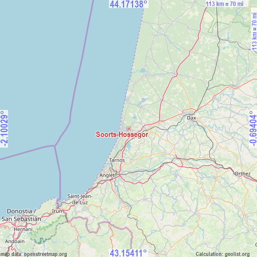
Soorts-Hossegor GPS coordinates[2]
43° 39' 53.64" North, 1° 23' 49.812" West
| Map corner | latitude | longitude |
|---|---|---|
| Upper-left | 44.17138°, | -2.10029° |
| Center: | 43.6649°, | -1.39717° |
| Lower-right: | 43.15411°, | -0.69404° |
| Map W x H: | 113.1×113.1 km | = 70.3×70.3mi |
| max Lat: | 51.07786° ⇑91% North |
| Soorts-Hossegor: | 43.6649° |
| min Lat: | ⇓9% South 41.3874° |
| min Long | Soorts-Hossegor | max Long |
| -5.08615° | -1.39717° | 9.52242° |
| W 8.5%⇐ | ⇒91.5% E |
Elevation
Elevation of Soorts-Hossegor is 15 m = 49 ft, and this is 178.7 m = 586 ft below average elevation for this country.
| Max E: |
2333 m = 7654 ft | 95.7% |
| Avg. | 193.7 m = 635 ft | |
| Soorts-Hossegor | 15 m = 49 ft | |
Min E: |
-1 m = -3 ft | 4.3% |
See also: France elevation on elevation.city.
Geographical zone
Soorts-Hossegor is located in North temperate zone (between Tropic of Cancer and the Arctic Circle). Distance of this Northern Tropic circle is 2249.2 km =1397.6 mi to South.| Distance of | km | miles | from Soorts-Hossegor |
|---|---|---|---|
| North Pole | 5152 | 3201.3 | to North |
| Arctic Circle | 2546.1 | 1582.1 | to North |
| Tropic Cancer | 2249.2 | 1397.6 | to South |
| Equator | 4855.1 | 3016.8 | to South |


Nearby cities:
15 places around Soorts-Hossegor: (largest is in red/bold)
• Angresse
2.2 km =1.4 mi,  110°
110°
• Bénesse-Maremne
4.5 km =2.8 mi,  134°
134°
• Capbreton
3.6 km =2.2 mi,  224°
224°
• Labenne
8.1 km =5 mi,  196°
196°
• Ondres
11.8 km =7.3 mi, 198°
• Saint-André-de-Seignanx
12.4 km =7.7 mi,  162°
162°
• Saint-Geours-de-Maremne
13.8 km =8.6 mi,  78°
78°
• Saint-Jean-de-Marsacq
12.1 km =7.5 mi, 111°
• Saint-Martin-de-Seignanx
13.6 km =8.5 mi,  177°
177°
• Saint-Vincent-de-Tyrosse
7.2 km =4.5 mi,  94°
94°
• Saubion
4 km =2.5 mi, 79°
• Saubrigues
9.1 km =5.7 mi, 132°
• Seignosse
3.4 km =2.1 mi,  40°
40°
• Soustons
11.3 km =7 mi,  29°
29°
• Tosse
5.8 km =3.6 mi,  62°
62°
Sources, notices
• [Note1] Compared only with cities in France existing in our database
• [Src1] Map data: © OpenStreetMap contributors (CC-BY-SA)
• [Src2] Other city data from geonames.org with taken over terms of usage.
• [Src3] Geographical zone / Annual Mean Temperature by Robert A. Rohde @ Wikipedia
