Saint-Jean-de-Marsacq geodata
Saint-Jean-de-Marsacq (Nouvelle-Aquitaine) is a populated place; located in France in Europe/Paris (GMT+2) time zone. With population of 974 people, there are 9031 cities with bigger population in this country. Compared to other cities in France, 91.5% of cities are located further ↑North; 90.4% of cities are located further →East and 87.1% of cities have higher elevation than Saint-Jean-de-Marsacq. Note1
Administrative division(s):
- Level 1: Nouvelle-Aquitaine
- Level 2: Landes
- Level 3: Arrondissement de Dax
- Level 4: Saint-Jean-de-Marsacq
Current local time in Saint-Jean-de-Marsacq:
11:28 AM, SaturdayDifference from your time zone: hours


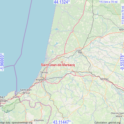
Saint-Jean-de-Marsacq GPS coordinates[2]
43° 37' 32.124" North, 1° 15' 24.84" West
| Map corner | latitude | longitude |
|---|---|---|
| Upper-left | 44.1324°, | -1.96003° |
| Center: | 43.62559°, | -1.2569° |
| Lower-right: | 43.11447°, | -0.55378° |
| Map W x H: | 113.2×113.2 km | = 70.3×70.3mi |
| max Lat: | 51.07786° ⇑91.5% North |
| Saint-Jean-de-Marsacq: | 43.62559° |
| min Lat: | ⇓8.5% South 41.3874° |
| min Long | Saint-Jean-de-M | max Long |
| -5.08615° | -1.2569° | 9.52242° |
| W 9.6%⇐ | ⇒90.4% E |
Elevation
Elevation of Saint-Jean-de-Marsacq is 37 m = 121 ft, and this is 156.7 m = 514 ft below average elevation for this country.
| Max E: |
2333 m = 7654 ft | 87.1% |
| Avg. | 193.7 m = 635 ft | |
| Saint-Jean-de-Marsacq | 37 m = 121 ft | |
Min E: |
-1 m = -3 ft | 12.9% |
See also: France elevation on elevation.city.
Geographical zone
Saint-Jean-de-Marsacq is located in North temperate zone (between Tropic of Cancer and the Arctic Circle). Distance of this Northern Tropic circle is 2244.8 km =1394.9 mi to South.| Distance of | km | miles | from Saint-Jean-de-Marsacq |
|---|---|---|---|
| North Pole | 5156.4 | 3204 | to North |
| Arctic Circle | 2550.5 | 1584.8 | to North |
| Tropic Cancer | 2244.8 | 1394.9 | to South |
| Equator | 4850.7 | 3014.1 | to South |


Nearby cities:
15 places around Saint-Jean-de-Marsacq: (largest is in red/bold)
• Angresse
9.9 km =6.2 mi,  291°
291°
• Biaudos
9.2 km =5.7 mi,  205°
205°
• Bénesse-Maremne
8.2 km =5.1 mi,  278°
278°
• Josse
3.5 km =2.2 mi,  58°
58°
• Orist
6.7 km =4.2 mi,  75°
75°
• Pey
4.5 km =2.8 mi,  85°
85°
• Port-de-Lanne
9.3 km =5.8 mi,  136°
136°
• Rivière-Saas-et-Gourby
10.5 km =6.5 mi,  54°
54°
• Saint-Geours-de-Maremne
7.4 km =4.6 mi,  17°
17°
• Saint-Martin-de-Hinx
4.9 km =3 mi,  190°
190°
• Saint-Vincent-de-Tyrosse
5.6 km =3.5 mi,  313°
313°
• Saubion
8.9 km =5.5 mi,  304°
304°
• Saubrigues
4.9 km =3 mi,  249°
249°
• Saubusse
6.8 km =4.2 mi, 57°
• Tosse
9.3 km =5.8 mi,  319°
319°
Sources, notices
• [Note1] Compared only with cities in France existing in our database
• [Src1] Map data: © OpenStreetMap contributors (CC-BY-SA)
• [Src2] Other city data from geonames.org with taken over terms of usage.
• [Src3] Geographical zone / Annual Mean Temperature by Robert A. Rohde @ Wikipedia
