Serrières-en-Chautagne geodata
Serrières-en-Chautagne (Auvergne-Rhône-Alpes) is a populated place; located in France in Europe/Paris (GMT+2) time zone. With population of 931 people, there are 9375 cities with bigger population in this country. Compared to other cities in France, 67.9% of cities are located further ↑North; 85.5% of cities are located further ←West and 75.1% of cities have lower elevation than Serrières-en-Chautagne. Note1
Administrative division(s):
- Level 1: Auvergne-Rhône-Alpes
- Level 2: Savoie
- Level 3: Arrondissement de Chambéry
- Level 4: Serrières-en-Chautagne
Current local time in Serrières-en-Chautagne:
08:37 AM, SaturdayDifference from your time zone: hours


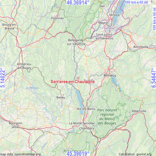
Serrières-en-Chautagne GPS coordinates[2]
45° 52' 54.552" North, 5° 50' 36.06" East
| Map corner | latitude | longitude |
|---|---|---|
| Upper-left | 46.36914°, | 5.14022° |
| Center: | 45.88182°, | 5.84335° |
| Lower-right: | 45.39019°, | 6.54647° |
| Map W x H: | 108.8×108.8 km | = 67.6×67.6mi |
| max Lat: | 51.07786° ⇑67.9% North |
| Serrières-en-Chautagne: | 45.88182° |
| min Lat: | ⇓32.1% South 41.3874° |
| min Long | Serrières-en-C | max Long |
| -5.08615° | 5.84335° | 9.52242° |
| W 85.5%⇐ | ⇒14.5% E |
Elevation
Elevation of Serrières-en-Chautagne is 250 m = 820 ft, and this is 56.3 m = 185 ft above average elevation for this country.
| Max E: |
2333 m = 7654 ft | 24.9% |
| Serrières-en-Chautagne | 250 m 820 ft | |
| Avg. | 193.7 m = 635 ft | |
Min E: |
-1 m = -3 ft | 75.1% |
See also: France elevation on elevation.city.
Geographical zone
Serrières-en-Chautagne is located in North temperate zone (between Tropic of Cancer and the Arctic Circle). Distance of this North polar circle is 2299.6 km =1428.9 mi to North.| Distance of | km | miles | from Serrières-en-Chautagne |
|---|---|---|---|
| North Pole | 4905.5 | 3048.1 | to North |
| Arctic Circle | 2299.6 | 1428.9 | to North |
| Tropic Cancer | 2495.7 | 1550.8 | to South |
| Equator | 5101.6 | 3170 | to South |


Nearby cities:
15 places around Serrières-en-Chautagne: (largest is in red/bold)
• Anglefort
4.2 km =2.6 mi,  321°
321°
• Chanaz
9 km =5.6 mi,  204°
204°
• Chindrieux
7 km =4.3 mi,  175°
175°
• Châtillon
9 km =5.6 mi, 179°
• Corbonod
9.7 km =6 mi,  350°
350°
• Culoz
5.8 km =3.6 mi,  230°
230°
• Massingy
8.3 km =5.2 mi,  134°
134°
• Moye
5.4 km =3.4 mi,  97°
97°
• Ruffieux
3.6 km =2.2 mi, 180°
• Rumilly
8.2 km =5.1 mi,  106°
106°
• Sales
9.1 km =5.7 mi, 95°
• Seyssel
8.6 km =5.3 mi, 353°
• Seyssel
8.6 km =5.3 mi,  356°
356°
• Vallières
7.7 km =4.8 mi,  74°
74°
• Versonnex
8.3 km =5.2 mi,  50°
50°
Sources, notices
• [Note1] Compared only with cities in France existing in our database
• [Src1] Map data: © OpenStreetMap contributors (CC-BY-SA)
• [Src2] Other city data from geonames.org with taken over terms of usage.
• [Src3] Geographical zone / Annual Mean Temperature by Robert A. Rohde @ Wikipedia
