Seyssel geodata
Seyssel (Auvergne-Rhône-Alpes) is a populated place; located in France in Europe/Paris (GMT+2) time zone. With population of 918 people, there are 9502 cities with bigger population in this country. Compared to other cities in France, 66.7% of cities are located further ↑North; 85.4% of cities are located further ←West and 76.9% of cities have lower elevation than Seyssel. Note1
Administrative division(s):
- Level 1: Auvergne-Rhône-Alpes
- Level 2: Haute-Savoie
- Level 3: Arrondissement de Saint-Julien-en-Genevois
- Level 4: Seyssel


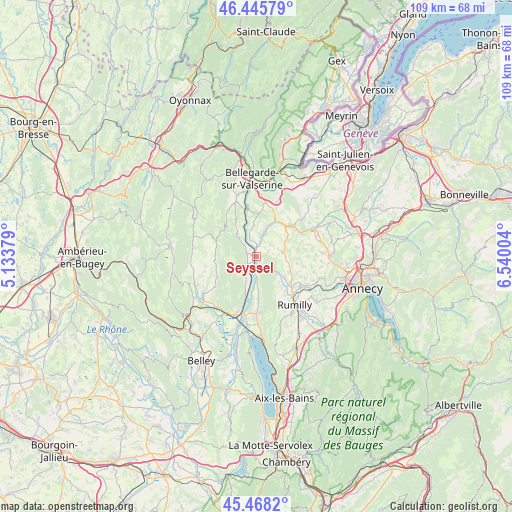
Seyssel GPS coordinates[2]
45° 57' 32.94" North, 5° 50' 12.912" East
| Map corner | latitude | longitude |
|---|---|---|
| Upper-left | 46.44579°, | 5.13379° |
| Center: | 45.95915°, | 5.83692° |
| Lower-right: | 45.4682°, | 6.54004° |
| Map W x H: | 108.7×108.7 km | = 67.5×67.5mi |
| max Lat: | 51.07786° ⇑66.7% North |
| Seyssel: | 45.95915° |
| min Lat: | ⇓33.3% South 41.3874° |
| min Long | Seyssel | max Long |
| -5.08615° | 5.83692° | 9.52242° |
| W 85.4%⇐ | ⇒14.6% E |
Elevation
Elevation of Seyssel is 263 m = 863 ft, and this is 69.3 m = 227 ft above average elevation for this country.
| Max E: |
2333 m = 7654 ft | 23.1% |
| Seyssel | 263 m 863 ft | |
| Avg. | 193.7 m = 635 ft | |
Min E: |
-1 m = -3 ft | 76.9% |
See also: France elevation on elevation.city.
Geographical zone
Seyssel is located in North temperate zone (between Tropic of Cancer and the Arctic Circle). Distance of this North polar circle is 2291 km =1423.6 mi to North.| Distance of | km | miles | from Seyssel |
|---|---|---|---|
| North Pole | 4896.9 | 3042.8 | to North |
| Arctic Circle | 2291 | 1423.6 | to North |
| Tropic Cancer | 2504.3 | 1556.1 | to South |
| Equator | 5110.2 | 3175.3 | to South |


Nearby cities:
15 places around Seyssel: (largest is in red/bold)
• Anglefort
5.7 km =3.5 mi,  202°
202°
• Chanay
6.5 km =4 mi,  321°
321°
• Chilly
9.8 km =6.1 mi,  68°
68°
• Corbonod
1.5 km =0.9 mi,  309°
309°
• Desingy
5.6 km =3.5 mi,  44°
44°
• Frangy
10 km =6.2 mi,  47°
47°
• Génissiat
10.7 km =6.6 mi,  345°
345°
• Hauteville-sur-Fier
12.2 km =7.6 mi,  120°
120°
• Menthonnex-sous-Clermont
7.6 km =4.7 mi,  85°
85°
• Moye
11 km =6.8 mi,  147°
147°
• Serrières-en-Chautagne
8.6 km =5.3 mi,  176°
176°
• Seyssel
0.4 km =0.2 mi,  268°
268°
• Thusy
9.1 km =5.7 mi,  99°
99°
• Vallières
10.2 km =6.3 mi,  129°
129°
• Versonnex
7.6 km =4.7 mi, 115°
Sources, notices
• [Note1] Compared only with cities in France existing in our database
• [Src1] Map data: © OpenStreetMap contributors (CC-BY-SA)
• [Src2] Other city data from geonames.org with taken over terms of usage.
• [Src3] Geographical zone / Annual Mean Temperature by Robert A. Rohde @ Wikipedia
