Schaeffersheim geodata
Schaeffersheim (Grand Est) is a populated place; located in France in Europe/Paris (GMT+2) time zone. With population of 744 people, there are 11239 cities with bigger population in this country. Compared to other cities in France, 66.8% of cities are located further ↓South; 98.7% of cities are located further ←West and 55.9% of cities have lower elevation than Schaeffersheim. Note1
Administrative division(s):
- Level 1: Grand Est
- Level 2: Bas-Rhin
- Level 3: Arrondissement de Sélestat-Erstein
- Level 4: Schaeffersheim


Schaeffersheim GPS coordinates[2]
48° 25' 41.232" North, 7° 37' 21.756" East
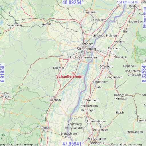
| Map corner | latitude | longitude |
|---|---|---|
| Upper-left | 48.89254°, | 6.91959° |
| Center: | 48.42812°, | 7.62271° |
| Lower-right: | 47.95941°, | 8.32584° |
| Map W x H: | 103.8×103.8 km | = 64.5×64.5mi |
| max Lat: | 51.07786° ⇑33.2% North |
| Schaeffersheim: | 48.42812° |
| min Lat: | ⇓66.8% South 41.3874° |
| min Long | Schaeffersheim | max Long |
| -5.08615° | 7.62271° | 9.52242° |
| W 98.7%⇐ | ⇒1.3% E |
Elevation
Elevation of Schaeffersheim is 153 m = 502 ft, and this is 40.7 m = 134 ft below average elevation for this country.
| Max E: |
2333 m = 7654 ft | 44.1% |
| Avg. | 193.7 m = 635 ft | |
| Schaeffersheim | 153 m = 502 ft | |
Min E: |
-1 m = -3 ft | 55.9% |
See also: France elevation on elevation.city.
Geographical zone
Schaeffersheim is located in North temperate zone (between Tropic of Cancer and the Arctic Circle). Distance of this North polar circle is 2016.5 km =1253 mi to North.| Distance of | km | miles | from Schaeffersheim |
|---|---|---|---|
| North Pole | 4622.4 | 2872.2 | to North |
| Arctic Circle | 2016.5 | 1253 | to North |
| Tropic Cancer | 2778.8 | 1726.7 | to South |
| Equator | 5384.7 | 3345.9 | to South |


Nearby cities:
15 places around Schaeffersheim: (largest is in red/bold)
• Benfeld
6.7 km =4.2 mi,  198°
198°
• Erstein
3 km =1.9 mi,  99°
99°
• Hindisheim
4.6 km =2.9 mi,  14°
14°
• Hipsheim
5.8 km =3.6 mi,  42°
42°
• Kertzfeld
6.7 km =4.2 mi,  216°
216°
• Krautergersheim
6.7 km =4.2 mi,  322°
322°
• Limersheim
3.4 km =2.1 mi,  28°
28°
• Lipsheim
7.8 km =4.8 mi, 25°
• Matzenheim
3.7 km =2.3 mi,  180°
180°
• Meistratzheim
6.3 km =3.9 mi,  291°
291°
• Nordhouse
4.4 km =2.7 mi,  58°
58°
• Osthouse
3.2 km =2 mi,  153°
153°
• Sand
5.1 km =3.2 mi,  188°
188°
• Uttenheim
2.7 km =1.7 mi, 223°
• Valff
7.6 km =4.7 mi,  264°
264°
Sources, notices
• [Note1] Compared only with cities in France existing in our database
• [Src1] Map data: © OpenStreetMap contributors (CC-BY-SA)
• [Src2] Other city data from geonames.org with taken over terms of usage.
• [Src3] Geographical zone / Annual Mean Temperature by Robert A. Rohde @ Wikipedia
