Krautergersheim geodata
Krautergersheim (Grand Est) is a populated place; located in France in Europe/Paris (GMT+2) time zone. With population of 1,586 people, there are 5886 cities with bigger population in this country. Compared to other cities in France, 67.8% of cities are located further ↓South; 98.4% of cities are located further ←West and 56.3% of cities have lower elevation than Krautergersheim. Note1
Administrative division(s):
- Level 1: Grand Est
- Level 2: Bas-Rhin
- Level 3: Arrondissement de Sélestat-Erstein
- Level 4: Krautergersheim


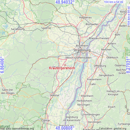
Krautergersheim GPS coordinates[2]
48° 28' 34.824" North, 7° 34' 1.848" East
| Map corner | latitude | longitude |
|---|---|---|
| Upper-left | 48.94032°, | 6.86406° |
| Center: | 48.47634°, | 7.56718° |
| Lower-right: | 48.00808°, | 8.27031° |
| Map W x H: | 103.7×103.7 km | = 64.4×64.4mi |
| max Lat: | 51.07786° ⇑32.2% North |
| Krautergersheim: | 48.47634° |
| min Lat: | ⇓67.8% South 41.3874° |
| min Long | Krautergersheim | max Long |
| -5.08615° | 7.56718° | 9.52242° |
| W 98.4%⇐ | ⇒1.6% E |
Elevation
Elevation of Krautergersheim is 155 m = 509 ft, and this is 38.7 m = 127 ft below average elevation for this country.
| Max E: |
2333 m = 7654 ft | 43.7% |
| Avg. | 193.7 m = 635 ft | |
| Krautergersheim | 155 m = 509 ft | |
Min E: |
-1 m = -3 ft | 56.3% |
See also: France elevation on elevation.city.
Geographical zone
Krautergersheim is located in North temperate zone (between Tropic of Cancer and the Arctic Circle). Distance of this North polar circle is 2011.1 km =1249.6 mi to North.| Distance of | km | miles | from Krautergersheim |
|---|---|---|---|
| North Pole | 4617 | 2868.9 | to North |
| Arctic Circle | 2011.1 | 1249.6 | to North |
| Tropic Cancer | 2784.1 | 1730 | to South |
| Equator | 5390.1 | 3349.3 | to South |


Nearby cities:
15 places around Krautergersheim: (largest is in red/bold)
• Altorf
5.8 km =3.6 mi,  330°
330°
• Bischoffsheim
5.8 km =3.6 mi,  281°
281°
• Blaesheim
4.6 km =2.9 mi,  42°
42°
• Duppigheim
6.1 km =3.8 mi,  18°
18°
• Duttlenheim
5.5 km =3.4 mi,  358°
358°
• Geispolsheim
7.4 km =4.6 mi,  53°
53°
• Griesheim-près-Molsheim
4 km =2.5 mi,  317°
317°
• Hindisheim
5.3 km =3.3 mi,  99°
99°
• Innenheim
2.3 km =1.4 mi,  13°
13°
• Limersheim
6.2 km =3.9 mi,  112°
112°
• Meistratzheim
3.6 km =2.2 mi,  209°
209°
• Niedernai
4.7 km =2.9 mi,  233°
233°
• Obernai
6.5 km =4 mi,  256°
256°
• Schaeffersheim
6.7 km =4.2 mi,  142°
142°
• Valff
7 km =4.3 mi, 209°
Sources, notices
• [Note1] Compared only with cities in France existing in our database
• [Src1] Map data: © OpenStreetMap contributors (CC-BY-SA)
• [Src2] Other city data from geonames.org with taken over terms of usage.
• [Src3] Geographical zone / Annual Mean Temperature by Robert A. Rohde @ Wikipedia
