Limersheim geodata
Limersheim (Grand Est) is a populated place; located in France in Europe/Paris (GMT+2) time zone. With population of 622 people, there are 12950 cities with bigger population in this country. Compared to other cities in France, 67.4% of cities are located further ↓South; 98.8% of cities are located further ←West and 55.9% of cities have lower elevation than Limersheim. Note1
Administrative division(s):
- Level 1: Grand Est
- Level 2: Bas-Rhin
- Level 3: Arrondissement de Sélestat-Erstein
- Level 4: Limersheim


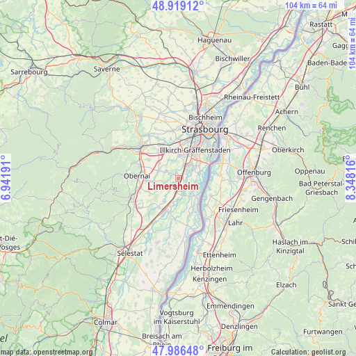
Limersheim GPS coordinates[2]
48° 27' 17.784" North, 7° 38' 42.108" East
| Map corner | latitude | longitude |
|---|---|---|
| Upper-left | 48.91912°, | 6.94191° |
| Center: | 48.45494°, | 7.64503° |
| Lower-right: | 47.98648°, | 8.34816° |
| Map W x H: | 103.7×103.7 km | = 64.4×64.4mi |
| max Lat: | 51.07786° ⇑32.6% North |
| Limersheim: | 48.45494° |
| min Lat: | ⇓67.4% South 41.3874° |
| min Long | Limersheim | max Long |
| -5.08615° | 7.64503° | 9.52242° |
| W 98.8%⇐ | ⇒1.2% E |
Elevation
Elevation of Limersheim is 153 m = 502 ft, and this is 40.7 m = 134 ft below average elevation for this country.
| Max E: |
2333 m = 7654 ft | 44.1% |
| Avg. | 193.7 m = 635 ft | |
| Limersheim | 153 m = 502 ft | |
Min E: |
-1 m = -3 ft | 55.9% |
See also: France elevation on elevation.city.
Geographical zone
Limersheim is located in North temperate zone (between Tropic of Cancer and the Arctic Circle). Distance of this North polar circle is 2013.5 km =1251.1 mi to North.| Distance of | km | miles | from Limersheim |
|---|---|---|---|
| North Pole | 4619.4 | 2870.4 | to North |
| Arctic Circle | 2013.5 | 1251.1 | to North |
| Tropic Cancer | 2781.8 | 1728.5 | to South |
| Equator | 5387.7 | 3347.8 | to South |


Nearby cities:
15 places around Limersheim: (largest is in red/bold)
• Blaesheim
6.3 km =3.9 mi,  335°
335°
• Erstein
3.7 km =2.3 mi,  159°
159°
• Eschau
6.5 km =4 mi,  54°
54°
• Fegersheim
4.7 km =2.9 mi,  34°
34°
• Geispolsheim
6.8 km =4.2 mi,  2°
2°
• Hindisheim
1.6 km =1 mi, 342°
• Hipsheim
2.6 km =1.6 mi,  60°
60°
• Krautergersheim
6.2 km =3.9 mi,  292°
292°
• Lipsheim
4.4 km =2.7 mi,  22°
22°
• Matzenheim
6.9 km =4.3 mi,  194°
194°
• Nordhouse
2.2 km =1.4 mi,  109°
109°
• Osthouse
5.9 km =3.7 mi,  181°
181°
• Plobsheim
6.1 km =3.8 mi,  74°
74°
• Schaeffersheim
3.4 km =2.1 mi,  208°
208°
• Uttenheim
6.1 km =3.8 mi,  215°
215°
Sources, notices
• [Note1] Compared only with cities in France existing in our database
• [Src1] Map data: © OpenStreetMap contributors (CC-BY-SA)
• [Src2] Other city data from geonames.org with taken over terms of usage.
• [Src3] Geographical zone / Annual Mean Temperature by Robert A. Rohde @ Wikipedia
